Mavic 3M in Extreme Temperatures: Field-Driven Mapping
Mavic 3M in Extreme Temperatures: Field-Driven Mapping Practices That Actually Hold Up
META: A technical review of Mavic 3M best practices for field mapping in extreme temperatures, with practical guidance on multispectral workflows, RTK fix reliability, flight altitude, and operator-led decision making.
When people talk about drone agriculture, they often jump straight to sensors, software, or broad promises about precision farming. That misses the harder question: what happens when the aircraft has to deliver reliable data in punishing field conditions?
That is where the Mavic 3M becomes worth examining carefully. Not as a generic “smart farming” platform, but as a working tool for operators mapping fields in heat, cold, wind, and variable crop conditions where every flight parameter affects downstream decisions. The timing of this discussion is useful. Commercial UAV Expo recently announced its 2026 opening keynote, “The View From the Field: What Operators, Pilots, and…”, built around an industry survey focused on real-world challenges and opportunities in commercial drone operations. That framing matters. It signals a shift away from polished marketing narratives and toward operator evidence.
For Mavic 3M users, especially those dealing with extreme temperatures, that operator-centered view is exactly the right one.
Why the field perspective matters for Mavic 3M operations
A multispectral mapping aircraft is only as valuable as the consistency of its outputs. In mild conditions, many workflows look good on paper. In extreme temperatures, small weaknesses become operational bottlenecks. Batteries sag. RTK convergence can become less predictable if mission planning is rushed. Wind can deform planned swath overlap. Light conditions can amplify inconsistency in plant reflectance capture. The result is not merely inconvenience. It is compromised agronomic interpretation.
This is why the Commercial UAV Expo keynote announcement is more than industry housekeeping. A session explicitly shaped by an operator survey on real-world challenges tells us something important: the commercial drone sector is maturing around what pilots and field teams actually experience, not what spec sheets imply. For Mavic 3M crews, that means best practice should start from repeatability under stress.
In agricultural mapping, “good enough” imagery gathered under difficult temperature conditions can still fail the farm manager if temporal comparisons are unreliable. The aircraft may complete the route. The data may process. Yet if a heat-stressed midday mission introduces avoidable variability, it becomes harder to distinguish true crop response from collection noise.
The Mavic 3M and the extreme-temperature mapping problem
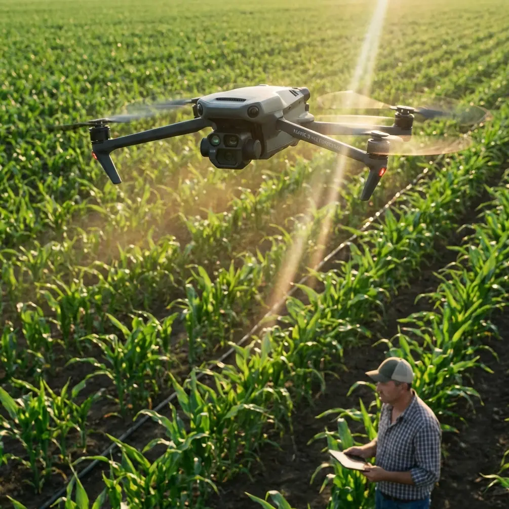
The Mavic 3M is attractive because it compresses a multispectral workflow into a compact airframe that can be deployed quickly across farms, research plots, orchards, and trial fields. For academic and operational users alike, that portability is a genuine advantage. But compact systems require disciplined flight planning when temperatures swing hard.
Extreme heat creates a specific set of problems. Battery thermal load rises before takeoff if packs are staged poorly. Surface shimmer can subtly degrade visual confidence during launch and recovery. More importantly, harsh sunlight and thermal stress can change the practical timing of data acquisition. If the objective is crop health comparison over time, then consistency in capture window becomes just as important as the platform itself.
Cold weather creates a different profile. Preflight battery conditioning becomes more critical, climb behavior can feel less forgiving, and crews often compress setup time because the environment is unpleasant. That tendency to rush is exactly what degrades mapping quality. The operator-centered message behind the 2026 industry keynote should be read as a warning here: the problems worth solving are rarely glamorous. They are procedural.
Optimal flight altitude: the most overlooked decision in hot and cold field mapping
If I had to isolate one decision that most strongly shapes usable Mavic 3M datasets in extreme temperatures, it would be flight altitude.
For most field-mapping missions with the Mavic 3M, an altitude around 60 to 80 meters above ground level is the practical sweet spot. That range usually balances three things that start fighting each other in difficult conditions: ground sample detail, coverage efficiency, and overlap integrity. Below that band, you gain detail but often pay with longer mission duration, more battery cycling, and a greater chance that temperature-related performance drift affects consistency across the field. Above that band, you improve area coverage, but you may reduce the clarity needed for identifying subtle crop stress transitions and edge variation.
In extreme heat, I generally favor the upper half of that band, often around 70 to 80 meters, when the crop structure and agronomic objective allow it. The reason is operational rather than theoretical. A slightly higher altitude increases swath width, shortens route complexity, and reduces the number of turns needed to cover the same block. Fewer turns mean smoother energy use and less cumulative mission stress on the aircraft. It also helps crews finish within a tighter illumination window.
In cold conditions, a 60 to 70 meter target often makes sense if the field is not excessively large. That can preserve the spatial detail needed for stand assessment or variable vigor analysis while keeping the mission short enough to avoid pushing battery reserves. The exact number should be driven by crop type, desired map resolution, and overlap requirements, but the key principle is stable repeatability. Use one altitude strategy consistently for comparable blocks and dates.
This is where terms like swath width and centimeter precision become more than jargon. A wider swath helps complete missions efficiently, but if you chase coverage at the expense of data fidelity, your map becomes less actionable. On the other hand, centimeter precision from an RTK-supported workflow is only truly useful if the mission geometry is stable from flight to flight. Altitude discipline is what connects those two outcomes.
RTK fix rate under thermal stress: why it deserves its own checklist
The Mavic 3M is often discussed in relation to precision agriculture, and rightly so. But in demanding temperature conditions, operators should pay less attention to vague claims about accuracy and more attention to RTK fix rate stability during the entire mission lifecycle.
A clean RTK fix before launch is not the same thing as a stable geospatial result across the sortie. In high-heat operations, crews often move too quickly from setup to takeoff to avoid standing in the sun. In cold conditions, they do the same because hands and devices become harder to manage. Both scenarios increase the temptation to treat RTK as a box to tick rather than a signal chain to verify.
The practical significance is straightforward. If your fix rate is inconsistent, temporal comparison across fields or across application zones becomes weaker. That matters when you are using multispectral data to evaluate irrigation patterns, nutrient response, emergence variability, or treatment efficacy. For research users, weak geospatial consistency can undermine trial plot interpretation. For production agriculture, it can blur field boundaries and mask repeatable stress signatures.
My recommendation is simple: build a short RTK confirmation routine into every extreme-weather mission. Verify status before takeoff, after the first line is established, and again before committing to the largest coverage block if your workflow allows. That extra minute is cheaper than a compromised dataset.
Multispectral value depends on collection discipline, not just the sensor stack
The Mavic 3M’s multispectral capability is the reason many operators bring it into serious agronomic workflows. But multispectral does not rescue bad mission planning. In fact, it punishes inconsistency more clearly than ordinary visual mapping.
When temperatures are extreme, plant response and ambient conditions can both change quickly. That means operators should standardize the following as tightly as possible:
- Time of day for repeat missions
- Flight altitude and overlap pattern
- Launch procedure and battery staging
- RTK verification routine
- Processing settings across comparable blocks
This is where the broader industry discussion highlighted by the 2026 keynote becomes highly relevant. An industry survey about real-world challenges suggests that operators are finally being heard on what actually limits outcomes: not whether drone technology is capable, but whether field workflows are repeatable under messy conditions. Mavic 3M users should take that seriously. If two datasets are collected with different thermal stress profiles, different altitudes, and different mission speeds, the maps may still look clean while being less comparable than expected.
A note on spray drift and nozzle calibration in a mapping workflow
The contextual overlap between mapping and application work is easy to underestimate. Even though the Mavic 3M is a mapping platform, the decisions it supports often feed directly into spray planning. That is why spray drift and nozzle calibration belong in this conversation.
If multispectral mapping is being used to define treatment zones, the quality of that map affects how agronomists and drone teams think about application timing, droplet behavior, and area targeting. In extreme temperatures, drift risk can rise due to evaporative conditions and unstable air movement, especially later in the day. A weak map can lead to overbroad treatment assumptions. A strong map, collected with disciplined altitude and RTK consistency, can support more selective intervention.
The significance here is operational. Mapping does not happen in isolation. It influences whether an application team narrows a treatment area, delays a pass, or revisits nozzle calibration assumptions to match the actual stress pattern in the field. Good multispectral mapping reduces downstream guesswork.
Practical workflow recommendations for extreme-temperature Mavic 3M missions
Here is the field logic I trust most:
1. Fly early when possible
In very hot conditions, prioritize morning windows. Not because that is a universal rule, but because it usually improves consistency in aircraft behavior, battery management, and crop reflectance conditions.
2. Keep altitude boringly consistent
For general field work, stay near 60 to 80 meters and do not change altitude casually between comparable missions. Consistency beats improvisation.
3. Shorten mission complexity before shortening overlap
If heat or cold is pressuring the sortie, simplify route design first. Do not immediately reduce overlap to save time. Overlap weakness is costly in multispectral reconstruction.
4. Track RTK fix behavior, not just preflight status
A stable fix is part of data quality. Treat it as such.
5. Build field notes into the deliverable
Record temperature conditions, wind behavior, cloud pattern, and any deviation from standard mission parameters. That is often what explains outlier results later.
6. Separate mapping decisions from application urgency
If a treatment decision is pending, there is a temptation to rush the mapping mission. Resist it. A hurried map can distort the application plan it was meant to improve.
The operator-led future is good news for serious Mavic 3M users
The strongest signal from the Commercial UAV Expo announcement is not the event itself. It is the fact that the 2026 opening keynote is anchored in survey feedback about what operators and pilots are dealing with in the field. That reflects an industry finally prioritizing practical friction points over abstract enthusiasm.
For Mavic 3M users, that is welcome progress. Extreme-temperature mapping is exactly the kind of use case where theory gets exposed. The aircraft can be highly effective, but only when the workflow respects environmental stress, mission geometry, and geospatial consistency. The useful conversation is no longer “Can this drone map crops?” It is “Can this crew produce agronomically defensible maps, repeatedly, when conditions are difficult?”
That is the standard that matters.
If your team is refining an extreme-weather mapping workflow and wants to compare field setups or mission parameters, you can message a Mavic 3M workflow specialist here to discuss operational details.
The Mavic 3M earns its place when flown with discipline. In heat, the right altitude can preserve efficiency without giving away interpretability. In cold, disciplined battery and RTK handling can keep small mistakes from becoming geospatial noise. And in both cases, the lesson is the same one now surfacing across the broader commercial drone industry: the real story comes from the field.
Ready for your own Mavic 3M? Contact our team for expert consultation.