Mavic 3M on Solar Farms: What Actually Matters in Complex
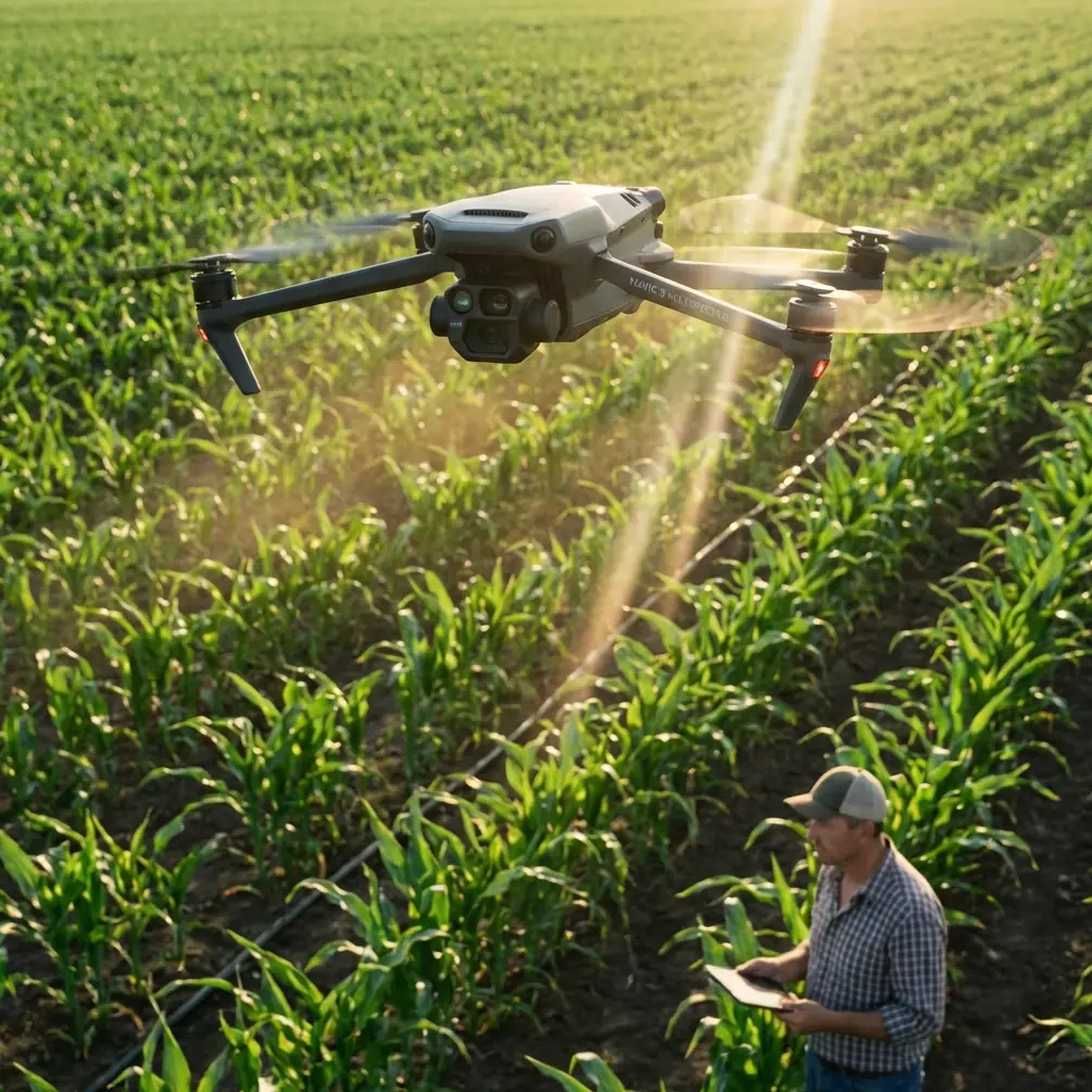
Mavic 3M on Solar Farms: What Actually Matters in Complex Terrain
META: A field-driven case study on using the DJI Mavic 3M for solar farm surveying in complex terrain, with practical insight on multispectral workflows, RTK reliability, and why cleaner imagery matters as much as sensor specs.
When people discuss the DJI Mavic 3M, the conversation usually starts with multispectral data and ends with vegetation maps. That makes sense in agriculture. It misses part of the story for solar sites.
On a solar farm built across uneven ground, with access roads cutting through slopes, drainage channels interrupting array blocks, and vegetation pressure changing by micro-topography, the real challenge is not simply collecting data. It is collecting imagery that stays readable when the site itself is visually messy. That distinction matters more than many teams admit.
I have seen technically capable surveys produce underwhelming decisions because the image layer was cluttered, inconsistent, or hard to interpret in context. Operators had data, but not clarity. And clarity is what drives maintenance crews, EPC teams, vegetation contractors, and asset owners toward action.
That is why the most useful way to think about the Mavic 3M for solar farms is not as a generic “multispectral drone.” It is a platform that reduces visual and analytical noise when terrain complexity would otherwise dilute the value of the mission.
A practical field scenario
Consider a utility-scale solar site spread across rolling land rather than a flat desert parcel. One ridge line drains cleanly. The lower section stays damp after rain. Some panel rows sit close to scrub encroachment, while others remain clear. The O&M team wants updated site intelligence for three reasons:
- Vegetation pressure around arrays
- Surface drainage patterns affecting access and erosion risk
- Spatial alignment of observed issues with engineering-grade coordinates
This is where the Mavic 3M starts to earn its place.
Its appeal is not just that it captures multispectral data. It is that the platform can tie those layers to high-accuracy positioning and a readable visual record, so you are not left guessing whether a stressed patch of vegetation near an inverter pad is truly expanding, or whether your last map and this week’s map simply do not align tightly enough.
For solar farms in complex terrain, that alignment issue is not trivial. Small positional inconsistencies can create false change, especially along row edges, drainage breaks, and service tracks.
Why “clean” imagery matters more than spec-sheet readers expect
A recent photography article made a simple point that applies surprisingly well to drone surveying: visual quality often suffers not because the camera is weak, but because the scene is cluttered. The article argued that one of the biggest visual differences between ordinary mobile photos and more refined images is background separation. When the background becomes less distracting, the subject becomes easier to read. It also noted that software portrait effects alone can look artificial, especially around edges.
At first glance, that has nothing to do with solar farm mapping. In practice, it has everything to do with it.
On a site with complex terrain, the “background” is all the irrelevant visual interference competing with the thing you actually need to understand: weed intrusion near string routes, drainage anomalies under the array, shadow transitions on slopes, access-lane degradation, or changing ground cover around substations.
The operational lesson is this: a usable survey is not just one with data layers. It is one that suppresses confusion.
The Mavic 3M performs well here because its mission output is not limited to a single visual style. You can use multispectral layers to isolate vegetation behavior, while the RGB context helps teams see whether a flagged zone is truly a maintenance concern or just a visually noisy patch caused by terrain texture, gravel contrast, or panel shadowing. In other words, the aircraft helps separate signal from background clutter.
That sounds abstract until you compare it to weaker workflows. With lower-confidence image products, teams often overreact to visual mess. They send crews to inspect “hot spots” that turn out to be non-issues, or they miss emerging edge encroachment because the site context is too confusing in standard imagery.
The case for Mavic 3M over less specialized options
Many drones can produce orthomosaics. That is no longer the differentiator.
What gives the Mavic 3M an advantage on solar sites with uneven land is the pairing of multispectral capture with RTK-supported positioning. The significance of RTK is not marketing language about precision. It is repeatability. If your fix quality is stable, your temporal comparisons become trustworthy. If your fix quality drifts, every “trend” becomes suspect.
For vegetation management around solar arrays, that is decisive. A centimeter-level workflow supports cleaner comparisons between survey cycles, especially when you are assessing narrow strips along fences, service roads, or panel perimeters. This is where the LSI phrase “Centimeter precision” stops being jargon and becomes operationally meaningful. On steep or segmented terrain, small geographic errors multiply quickly when managers try to compare one mission against another.
I often tell site teams to pay attention to RTK Fix rate not because they need another dashboard metric, but because poor fix continuity quietly contaminates decisions. If you are trying to determine whether growth is creeping toward lower panel edges, and your geospatial consistency is soft, you are not measuring change. You are measuring uncertainty.
The Mavic 3M is strong precisely because it reduces that uncertainty in a compact field package.
Compared with more general-purpose drones, it also excels when the mission objective is vegetation intelligence rather than just visual documentation. That distinction matters on solar farms, where overgrowth is not a cosmetic issue. It can affect access, airflow, drainage maintenance, firebreak integrity, and long-term asset management.
Multispectral is not just for crops
Some solar operators hesitate when they hear “multispectral,” assuming the tool belongs to agronomy teams, not energy infrastructure managers. That is too narrow a view.
On a solar site, multispectral analysis can highlight vegetation vigor gradients that are easy to miss in standard RGB imagery, especially across terrain transitions. A lower basin may sustain growth longer than ridge sections. Fence lines may host denser intrusion corridors. Disturbed soil after maintenance may become recolonized unevenly. Areas near drainage infrastructure can show persistent regrowth patterns that standard visual review underestimates.
The Mavic 3M helps turn those subtle patterns into a structured map.
That changes how maintenance is planned. Instead of blanket mowing or reactive inspections, crews can prioritize based on actual condition patterns. The result is more selective intervention and fewer wasted site visits.
There is also a secondary benefit for compliance and reporting. When stakeholders ask why one block was prioritized over another, a multispectral survey tied to stable positioning gives a defensible answer.
Complex terrain changes the mission design
Flat solar farms reward simple flight planning. Complex terrain does not.
On hilly or irregular sites, swath width, overlap strategy, sun angle, and elevation variation all influence output quality. Terrain-induced shadowing can complicate interpretation, particularly where rows step down slopes or where service roads cut across grade. The Mavic 3M does not remove those challenges, but it gives the operator a more appropriate toolkit for managing them.
This is where experienced operators pull ahead of checkbox pilots.
A solar mission in broken terrain should be designed around analytical intent, not just coverage speed. If the goal is vegetation encroachment mapping, the swath width and overlap settings need to support consistent reconstruction near panel boundaries and service margins. If the goal includes drainage observation, timing and light conditions become more significant. If the goal is recurring seasonal comparison, then mission replication and RTK consistency are central.
The platform supports this kind of disciplined survey architecture. That is why it fits serious asset workflows better than drones chosen only for convenience.
A subtle but real advantage: fewer false visual cues
The earlier photography reference made another point worth borrowing: simply enabling a software effect does not guarantee a natural result, and edge artifacts can make an image look fake.
The drone equivalent is relying on automated outputs without questioning whether boundaries are real.
On a solar farm, false edge interpretation is costly. Vegetation boundaries near array rows, gravel-to-soil transitions, and disturbed maintenance corridors can all confuse simplistic review methods. If your workflow creates ambiguous edges, your teams will either over-mark areas for action or miss the ones that matter.
The Mavic 3M’s value is that it supports a more trustworthy boundary reading when multispectral and RGB outputs are interpreted together. That does not mean every map is self-explanatory. It means the platform gives analysts fewer artificial cues and stronger evidence.
For field teams, that translates into cleaner work orders. Not “inspect the messy area near the lower slope,” but “inspect the northwestern drainage-adjacent strip where vigor has increased consistently across repeat surveys.”
That level of specificity reduces wasted labor.
Where this becomes especially useful on solar sites
Three recurring use cases stand out.
1. Vegetation encroachment near arrays
Multispectral output can identify growth trends before they become visually dramatic in standard imagery. In operational terms, that means earlier intervention and less emergency clearing.
2. Terrain-linked maintenance planning
When the site includes slopes, low spots, and runoff pathways, vegetation and ground condition rarely behave uniformly. A properly georeferenced Mavic 3M survey helps maintenance teams target the troublesome sections rather than treating the whole site as if it were flat and consistent.
3. Repeatable documentation for asset management
A one-off map is useful. A repeatable map set is valuable. RTK-backed consistency supports seasonal comparison, contractor verification, and internal reporting with much more confidence.
What experienced operators should watch
The drone does not make survey discipline optional.
If you are deploying the Mavic 3M on complex solar sites, focus on:
- RTK Fix rate stability throughout the mission
- Flight design that respects terrain variation
- Consistent mission parameters between survey cycles
- Interpretation workflows that combine multispectral and RGB context
- Output review that distinguishes true edge conditions from visual clutter
That last point brings us back to the photography lesson. The original article centered on 4 practical shooting techniques for beginners, built around a single visual truth: clutter ruins impact, and artificial shortcuts do not reliably solve the problem. That exact principle carries into drone operations. On solar farms, cluttered imagery and weak edge definition create analysis friction. Better capture and better contextual interpretation produce better decisions.
If your team is comparing aircraft options, this is where the Mavic 3M stands out from less specialized competitors. It is not merely capable of flying the site. It is better suited to producing a survey that remains legible when the terrain is complicated, the vegetation is uneven, and the asset owner needs more than pretty maps.
Final field perspective
The strongest argument for the Mavic 3M on solar farms is not that it offers advanced sensing. Several platforms claim advanced sensing.
The stronger argument is that it helps transform a visually confusing site into an interpretable operational model. That is a bigger win than it sounds. Solar farms in complex terrain generate noise—literal, visual, and analytical. The aircraft’s multispectral capability helps isolate biological patterns. RTK-supported positioning helps preserve spatial trust. Together, those two details have direct operational significance: fewer false trends, better maintenance targeting, and more reliable repeat surveys.
If you are designing a workflow for utility-scale sites and want to compare mission architecture, sensor fit, or field setup details, you can discuss real project requirements here: message our UAV team on WhatsApp.
For teams responsible for difficult solar terrain, that is the real benchmark. Not whether a drone can collect data, but whether the data remains useful after the flight is over.
Ready for your own Mavic 3M? Contact our team for expert consultation.