Mavic 3M for High-Altitude Coastline Inspection: What a 10
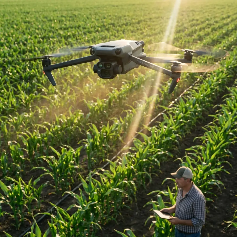
Mavic 3M for High-Altitude Coastline Inspection: What a 10-Minute Emergency Drone Workflow Teaches Serious Operators
META: Learn how recent Chinese emergency drone deployment and autonomous mission data translate into smarter high-altitude coastline inspection with the DJI Mavic 3M, including altitude, RTK, multispectral, and operational planning insights.
Coastline inspection is rarely a simple mapping exercise. Wind shear changes by the minute. Salt haze softens contrast. Reflective water punishes poor exposure decisions. And when the mission is flown at higher altitude to cover broad shoreline sections efficiently, small mistakes in planning turn into missed anomalies, weak datasets, and expensive re-flights.
That is why a recent emergency-response deployment in Suining deserves closer attention from Mavic 3M operators, even though the news itself came from the firefighting world rather than environmental or infrastructure surveying. In the public debut of the city’s first “air reconnaissance drones,” a unit reportedly received a smoke alert, launched automatically along a preset route, completed 3D modeling, identified trapped persons, and returned real-time video in under 10 minutes. Just as significant, the aircraft operated from an automated rooftop dock and supported an “air-ground integrated” response model rather than a standalone drone sortie.
For anyone inspecting coastlines with a Mavic 3M, those details are not just interesting. They point to the operating logic that increasingly separates useful drone data from merely collected drone data.
Why this emergency-drone story matters to Mavic 3M users
The obvious difference is platform purpose. A fire reconnaissance drone is optimized for urgent response. The Mavic 3M is built around multispectral and RGB intelligence for agriculture and analytical field work. But the overlap is operational, not cosmetic.
The Suining workflow highlights three capabilities that matter directly in coastal inspection:
- Fast mission execution from prebuilt routes
- Actionable imaging, not just image capture
- Tight integration between aircraft and ground decision-making
Those same three pillars define successful Mavic 3M work on shorelines, especially when the aircraft is tasked with broad-area review from elevated flight profiles.
A coastline operator often faces a tradeoff: fly lower and collect richer detail, or fly higher and gain efficiency. The right answer is usually neither extreme. It is a disciplined altitude band supported by RTK stability, good overlap, and a clear understanding of what anomalies matter most.
The Suining case is instructive because the mission was not described as a leisurely documentation flight. It was a targeted reconnaissance chain: launch, navigate, build situational awareness, identify critical elements, and feed that information back immediately. When the whole sequence is completed in less than 10 minutes, the lesson is straightforward: the real performance benchmark is not airtime alone. It is how quickly the collected data can support a decision.
For Mavic 3M coastline inspection, that means your flight plan should be designed around interpretable outputs: vegetation stress zones in dune systems, drainage irregularities near embankments, erosion signatures along the edge line, standing water pockets, and possible contamination spread patterns after weather events.
The operational significance of “preset route” flying
One of the strongest details in the Suining report is that the drone launched automatically and flew a preset route to the target area. This matters because repetitive operations over dynamic geography benefit from repeatability far more than pilots sometimes admit.
Coastlines change, but they also need to be compared over time. If you inspect the same marsh edge, sea wall corridor, or tidal transition zone every month, inconsistency in route geometry can reduce the value of your multispectral record. Changes in angle, altitude, overlap, and timing can create false differences that look like environmental change but are really just acquisition noise.
With the Mavic 3M, building repeatable route templates is one of the smartest ways to improve interpretive confidence. That includes:
- Holding a stable survey altitude
- Maintaining consistent overlap
- Preserving similar sun-angle windows when possible
- Repeating track direction if crosswind allows
- Using RTK to stabilize positional consistency
This is where the LSI term RTK Fix rate becomes operationally meaningful rather than technical decoration. In a high-altitude coastline mission, the higher you fly, the more area each image covers. That sounds efficient, but it also means each geospatial error can affect a wider footprint. Strong RTK performance helps keep multispectral layers aligned and supports cleaner comparisons between flights.
If your goal is to monitor coastal vegetation encroachment, wetland stress, or erosion progression with centimeter precision, route discipline matters just as much as sensor quality.
The less obvious lesson from 3D modeling and victim localization
Another detail from the Suining deployment deserves attention: the mission included 3D modeling and locking onto trapped individuals. In emergency response, that is about life safety. In coastline inspection, the principle is different but the value is similar: data must resolve from broad awareness into specific targets.
The Mavic 3M is not a search-and-rescue aircraft, but it is excellent at narrowing attention. Multispectral imagery can highlight subtle changes in plant vigor, moisture-related stress, and transition boundaries that a standard visual pass may miss. Along a coastline, this is especially useful in areas where early-stage degradation does not yet look dramatic to the naked eye.
A practical workflow looks like this:
- First pass at moderate altitude for broad coverage
- Identify suspicious spectral signatures
- Launch targeted lower-altitude verification passes
- Cross-check with RGB imagery and terrain context
- Mark revisit points for future trend analysis
This mirrors the reconnaissance logic from the Suining story. Broad scan first. Precise attention second. Decision support throughout.
That approach is also far safer and more efficient than trying to fly every meter of coastline at unnecessarily low altitude. Higher-altitude collection has a place. The real skill lies in knowing when to use it as a screening layer rather than pretending it can solve every inspection objective in one pass.
Optimal flight altitude for high-altitude coastline inspection with Mavic 3M
If you are inspecting coastlines in high altitude conditions—or simply flying higher to maximize coverage over long coastal corridors—the optimal altitude is usually not “as high as regulations allow.” That is lazy planning. The better answer depends on what you are trying to detect.
For most Mavic 3M coastline screening missions, I recommend starting with a moderate-high operational band rather than an extreme one. In practical terms, that often means building your main mapping plan around the altitude that still preserves reliable multispectral discrimination of shoreline vegetation patterns and edge instability, while leaving room for secondary low-altitude verification.
Why not just fly as high as possible?
Because coastal environments are visually deceptive. Water glare, wet sand reflectance, aerosol haze, and wind-driven vegetation motion already degrade clean interpretation. Add too much altitude and you start diluting the very signatures you are trying to analyze. The dataset may look efficient on paper while quietly losing diagnostic value.
A workable rule is this:
- Use your highest altitude only for broad corridor context
- Use your primary mapping altitude for actionable multispectral detail
- Use a lower-altitude follow-up for anomaly confirmation
For many coastline missions, the sweet spot is the altitude where the Mavic 3M still produces stable multispectral separation across vegetation bands, tidal-edge transitions, and disturbed soil margins without forcing excessive mission time. In stronger coastal winds, slightly lower altitude often improves consistency because the aircraft experiences less exposure and the imagery shows less motion distortion.
That is the operational version of “optimal altitude.” Not maximum altitude. Optimal.
What “air-ground integrated” should mean for your inspections
The Suining report describes the launch as part of an “air-ground integrated” model. That phrase is easy to gloss over, but it is the most strategically important detail in the story.
Too many drone inspections remain air-only exercises. The team flies, downloads files, builds maps, and then someone else tries to make sense of the output later. That creates lag, missed context, and sometimes the wrong follow-up actions.
For coastline work with the Mavic 3M, air-ground integration should mean that your drone mission is directly linked to field interpretation and maintenance response. If the aircraft flags a vegetation stress band near a levee shoulder, the ground team should know whether the likely cause is salt intrusion, drainage blockage, or physical disturbance. If a multispectral signature suggests washout progression, that point should drive a boots-on-ground verification path, not sit in a folder waiting for next week’s review.
The real value of drone intelligence comes from shortening the distance between detection and response.
That same logic explains why the Suining system’s real-time image return matters. In emergency service, live video supports immediate command decisions. In coastal inspection, rapid review can help teams determine whether they need another pass while the aircraft is still on site. That alone can prevent re-mobilization.
If your team wants to compare route design or field workflow choices for this kind of mission, it makes sense to message an operator planning specialist here while you are still building your inspection template rather than after a weak first dataset.
Multispectral value on coastlines: where Mavic 3M earns its keep
Coastline inspection is often thought of as a visual job: cracks, erosion, debris, flood damage. Those are important, but they are also late-stage indicators in many cases. The Mavic 3M becomes more valuable when the mission asks earlier questions.
For example:
- Is shoreline vegetation under stress before visible dieback appears?
- Are dune stabilization zones becoming uneven?
- Is drainage creating moisture patterns that could weaken adjacent landforms?
- Is there a widening transition band between healthy and compromised cover?
- Is post-storm recovery progressing evenly across a management area?
This is where multispectral data becomes materially useful. It helps move the inspection from surface observation toward condition inference.
And although some of the contextual keyword set around the Mavic ecosystem includes terms like spray drift, nozzle calibration, swath width, and IPX6K, those belong more naturally to application and spray-platform conversations than to a Mavic 3M coastline mission. Still, the contrast is useful. It reminds us that platform selection should follow mission logic, not keyword familiarity. For coastline analysis, the conversation should center on multispectral stability, route repeatability, RTK reliability, environmental timing, and data interpretation.
A practical mission design for coastal teams
Borrowing from the emergency reconnaissance logic in the Suining deployment, a stronger Mavic 3M coastline workflow often follows this sequence:
1. Predefine coastal sectors
Break long shoreline stretches into repeatable mission blocks. This mirrors the value of preset-route response. Each sector should have a clear objective: erosion watch, vegetation stress, drainage monitoring, storm impact, or embankment review.
2. Launch into a broad screening pass
Fly at a moderate-high altitude that balances coverage and spectral clarity. Prioritize consistency over speed-chasing.
3. Review for anomaly clusters immediately
Do not wait until the end of the day. Rapid assessment helps decide whether additional targeted flights are needed while conditions are still comparable.
4. Run verification passes at lower altitude
Use these for edge detail, geometry confirmation, and RGB cross-checking.
5. Tie outputs to field action
A flagged zone should produce a defined next step: inspect, sample, repair, monitor, or archive for trend comparison.
This is how drone programs mature. Not by flying more often, but by making each sortie structurally more useful.
The wider signal from China’s recent UAV news
Even the other reference item in the background—the report that a Chengdu-built hydrogen-powered 50 kg-class UAV previously achieved a national record of 30 hours of continuous day-night flight—reinforces the same industry direction. Endurance, autonomy, and integrated control are improving quickly. But endurance alone is not the real story for Mavic 3M users.
The more relevant takeaway is that UAV operations are being designed as systems. Not isolated aircraft. Systems with repeatable deployment, integrated control logic, and mission-specific outputs.
The Suining drone debut fits that pattern perfectly. Automated takeoff from a smart rooftop dock. Preset routing. Real-time return. Fast modeling. Clear operational objective. That is why it matters beyond firefighting.
For a Mavic 3M operator inspecting coastlines at higher altitude, the message is simple: stop evaluating flights only by coverage and battery use. Evaluate them by how fast they produce trustworthy environmental decisions.
Final take
The Suining deployment showed a public-facing drone mission that moved from alert to modeled situational awareness in under 10 minutes. That is a hard operational benchmark, not a publicity flourish. It demonstrates what happens when route planning, autonomy, sensing, and command response are built into one workflow.
For Mavic 3M coastline inspection, the transferable lesson is clear. Build repeatable routes. Use RTK to protect spatial consistency. Treat high altitude as a screening tool, not a shortcut. Let multispectral data identify subtle coastal change before visible damage dominates the scene. And connect every flight to a ground action pathway.
That is how a Mavic 3M becomes more than a capable aircraft. It becomes a disciplined reconnaissance instrument for coastal decision-making.
Ready for your own Mavic 3M? Contact our team for expert consultation.