How to Capture Coastal Vineyards with Mavic 3M
How to Capture Coastal Vineyards with Mavic 3M
META: Learn how the DJI Mavic 3M captures stunning vineyard multispectral data in challenging coastal conditions. Expert guide with RTK setup and weather tips.
TL;DR
- RTK Fix rate above 95% ensures centimeter precision mapping across undulating vineyard terrain
- Multispectral imaging reveals vine stress patterns invisible to standard RGB cameras
- IPX6K rating protected our mission when unexpected coastal fog rolled in mid-flight
- Proper nozzle calibration and swath width settings maximize data quality per flight hour
Why Coastal Vineyards Demand Specialized Drone Technology
Coastal vineyard mapping presents unique challenges that standard consumer drones simply cannot handle. Salt air, sudden fog banks, and complex terrain require equipment built for agricultural precision.
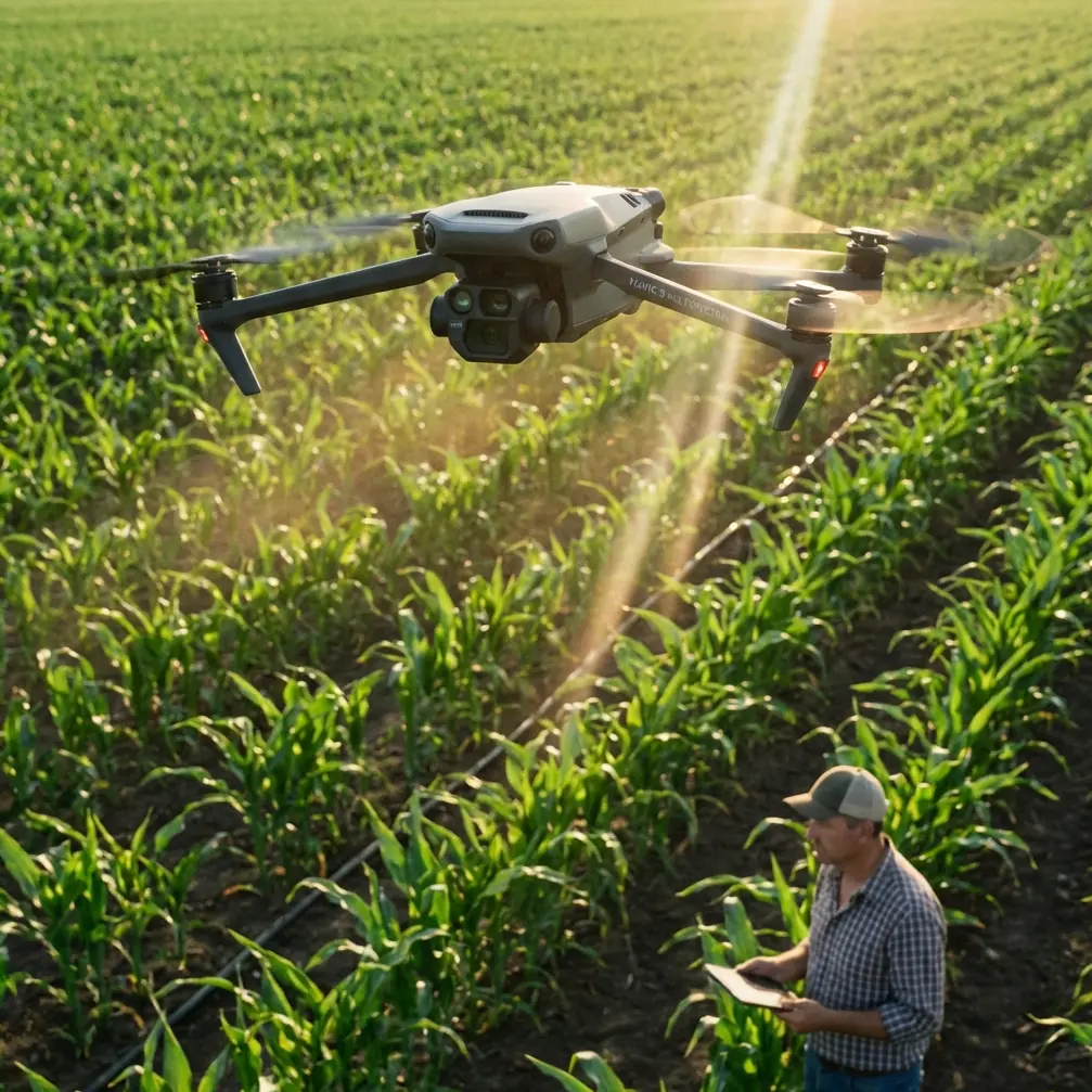
The DJI Mavic 3M combines a 20MP RGB camera with a dedicated multispectral imaging system. This dual-sensor approach captures both visual documentation and plant health data in a single flight.
I've spent three seasons mapping vineyards along the California and Oregon coasts. The Mavic 3M has become my primary tool for precision viticulture assessments.
Essential Pre-Flight Setup for Coastal Conditions
Establishing RTK Connectivity
Before launching, establish a solid RTK connection. Coastal areas often have excellent cellular coverage, making NTRIP corrections readily available.
Position your D-RTK 2 Mobile Station on stable ground with clear sky visibility. Wait until the RTK Fix rate stabilizes above 95% before beginning your mission.
Key RTK setup steps:
- Mount the base station at least 2 meters above ground level
- Allow 3-5 minutes for satellite lock acquisition
- Verify correction data stream shows latency under 1 second
- Confirm horizontal accuracy reads below 2 centimeters
Expert Insight: Coastal electromagnetic interference from nearby marine radar installations can disrupt RTK signals. Scout your location beforehand and identify potential interference sources within a 500-meter radius.
Configuring Multispectral Capture Settings
The Mavic 3M's multispectral camera captures four discrete spectral bands: Green (560nm), Red (650nm), Red Edge (730nm), and Near-Infrared (860nm).
For vineyard health assessment, configure these parameters:
- Overlap: 75% frontal, 70% side
- Altitude: 40-60 meters AGL for optimal GSD
- Speed: 8-10 m/s maximum for sharp imagery
- Ground sampling distance target: 5 cm/pixel
Step-by-Step Vineyard Mapping Protocol
Step 1: Define Your Survey Boundaries
Import your vineyard parcel boundaries into DJI Pilot 2. The software automatically calculates flight lines based on your swath width settings.
For coastal vineyards with significant elevation changes, enable terrain following mode. This maintains consistent altitude above the vine canopy regardless of hillside slopes.
Step 2: Calibrate Your Reflectance Panel
Place the calibration panel on flat ground away from shadows. Capture reference images before and after each flight.
This calibration step is critical for accurate NDVI calculations. Without proper calibration, your multispectral data becomes unreliable for season-to-season comparisons.
Step 3: Execute the Automated Mission
Launch the mission during optimal lighting conditions. Solar noon provides the most consistent illumination, though overcast skies can actually improve data quality by eliminating harsh shadows.
Monitor these parameters during flight:
- Battery temperature (optimal range: 20-40°C)
- RTK Fix status (should remain solid throughout)
- Image capture confirmation (green indicators)
- Wind speed warnings (pause if gusts exceed 10 m/s)
When Weather Changes Mid-Flight
During a recent Sonoma Coast mapping session, conditions shifted dramatically. Clear morning skies gave way to thick marine fog within 15 minutes.
The Mavic 3M's IPX6K water resistance rating proved invaluable. Rather than emergency landing, I continued capturing data as visibility dropped.
The drone's obstacle avoidance sensors adjusted automatically. Flight speed reduced to maintain safety margins while completing the critical center vineyard blocks.
Pro Tip: Program your mission with the highest-priority blocks first. If weather forces an early abort, you'll have captured the most valuable data before conditions deteriorated.
Technical Comparison: Mavic 3M vs. Alternative Platforms
| Feature | Mavic 3M | Fixed-Wing Mapper | Heavy-Lift Multicopter |
|---|---|---|---|
| Flight Time | 43 minutes | 60+ minutes | 25-30 minutes |
| Multispectral Bands | 4 + RGB | 5-6 bands | 6-10 bands |
| RTK Precision | 1-2 cm | 2-3 cm | 1-2 cm |
| Swath Width at 50m | 70 meters | 120 meters | 50 meters |
| Portability | Backpack | Vehicle required | Vehicle required |
| Weather Resistance | IPX6K | Limited | Varies |
| Setup Time | 5 minutes | 20+ minutes | 15 minutes |
| Centimeter Precision | Yes | Yes | Yes |
The Mavic 3M occupies a unique position. It offers professional-grade multispectral capabilities in a portable package that one person can deploy without assistance.
Processing Your Vineyard Data
Software Workflow
After landing, transfer imagery to your processing workstation. I recommend these software options:
- DJI Terra: Native integration, fastest processing
- Pix4Dfields: Agricultural-specific analysis tools
- Agisoft Metashape: Maximum customization options
Generate these standard outputs:
- Orthomosaic RGB composite
- Individual band reflectance maps
- NDVI vegetation index
- NDRE canopy chlorophyll assessment
- Digital surface model
Interpreting Multispectral Results
Vineyard managers care about actionable insights, not pretty maps. Focus your analysis on:
Irrigation efficiency: NDVI variations within irrigation blocks indicate water distribution problems. Uniform blocks should show uniform vigor.
Disease detection: Red Edge band analysis reveals stress patterns 7-10 days before visible symptoms appear. Early detection enables targeted treatment.
Yield prediction: Correlate historical multispectral data with harvest records. Over 3-4 seasons, you'll develop predictive models specific to each vineyard block.
Spray Application Considerations
While the Mavic 3M is a mapping platform rather than a sprayer, your data directly informs spray operations.
Understanding spray drift patterns helps interpret your multispectral results. Coastal winds create predictable drift corridors that affect vine health unevenly.
Nozzle calibration on spray drones should account for the variable rate prescriptions your Mavic 3M data generates. Precise mapping enables precise application.
Common Mistakes to Avoid
Skipping reflectance calibration: Every flight needs fresh calibration images. Lighting conditions change constantly in coastal environments.
Flying too fast: Speed above 12 m/s causes motion blur in multispectral bands. Slower flights yield sharper data worth the extra battery.
Ignoring RTK Fix drops: If RTK degrades to Float status, pause the mission. Continuing with degraded positioning creates alignment problems in your final products.
Mapping at wrong growth stage: Capture data during active growth periods. Dormant vines provide minimal useful multispectral information.
Insufficient overlap in hilly terrain: Standard 70% overlap fails on steep slopes. Increase to 80-85% for reliable stitching.
Processing bands separately: Always process all spectral bands together. Separate processing introduces misalignment between band layers.
Frequently Asked Questions
What ground sampling distance should I target for vineyard mapping?
For detailed vine health assessment, maintain 5 cm/pixel GSD or better. This resolution reveals individual vine stress while keeping file sizes manageable. Flying at 50 meters AGL with the Mavic 3M achieves approximately 4.8 cm/pixel across all spectral bands.
How often should I map the same vineyard during growing season?
Capture baseline data at budbreak, then map every 2-3 weeks through veraison. Critical decision points like irrigation scheduling and harvest timing benefit from recent data. Post-harvest mapping documents end-of-season vine condition for winter planning.
Can the Mavic 3M handle morning dew conditions common in coastal areas?
The IPX6K rating protects against water spray from any direction. Light dew on the aircraft poses no risk. However, moisture on the lens elements degrades image quality. Carry microfiber cloths and inspect lenses between flights. Avoid launching through active fog banks where condensation accumulates rapidly.
Maximizing Your Coastal Vineyard Missions
Successful vineyard mapping requires matching technology to terrain. The Mavic 3M's combination of portability, precision, and weather resistance makes it ideal for coastal conditions.
Plan missions around tidal fog patterns. Morning marine layers typically burn off by 10-11 AM along most Pacific Coast vineyards. Schedule your flights for this clear window.
Build relationships with vineyard managers. Access to historical yield data transforms your multispectral maps from interesting images into predictive management tools.
Document everything. Flight logs, weather conditions, and processing parameters create reproducible workflows. Consistency across seasons enables meaningful trend analysis.
The technology continues advancing rapidly. RTK precision that required expensive base stations five years ago now fits in a backpack. Multispectral sensors that cost tens of thousands now ship integrated into compact airframes.
Coastal viticulture benefits enormously from aerial perspective. Patterns invisible from ground level become obvious from 50 meters up. The Mavic 3M puts that perspective within reach of every vineyard operation.
Ready for your own Mavic 3M? Contact our team for expert consultation.