Mavic 3M for Low-Light Solar Farm Mapping
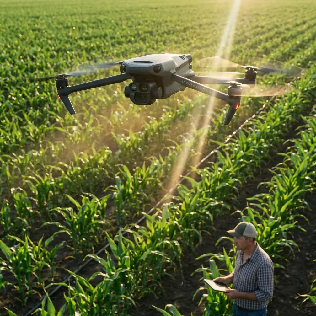
Mavic 3M for Low-Light Solar Farm Mapping: Why Field of View Matters More Than Blind Zoom
META: A practical expert guide to using the DJI Mavic 3M for mapping solar farms in low light, with a focus on wide-field capture, multispectral workflow, RTK precision, and real-world operational decisions.
Solar farm mapping gets difficult at the exact moment operators need clean data most: early morning, late afternoon, overcast weather, and those short winter windows when crews are chasing output issues before daylight fades.
That is where a lot of pilots make the wrong move.
They tighten the view, zoom in, and assume a closer image will produce better intelligence. It usually does the opposite. Coverage slows down, spatial context disappears, overlap planning gets messy, and subtle patterns across rows become harder to interpret. The mistake is familiar to anyone who has watched new image-makers work with cameras: they zoom first and think later. The better method is to match the field of view to the scene.
That principle shows up even in basic photography advice. One recent camera-focused reference made a simple but useful point: beginners often get weak results because they choose the wrong zoom level and enlarge blindly. It argued that image quality depends less on expensive hardware than on matching focal length to the subject. For broad landscapes, the recommended range was 0.5x to 1x, because a wider view creates stronger spatial layering and a clearer sense of depth. It also singled out low-angle compositions of trees, buildings, and mountains, noting that 0.5x–1x framing stretches the foreground and makes scale easier to read.
That may sound like phone photography trivia. In practice, it maps neatly onto how the Mavic 3M should be flown over utility-scale solar sites.
The real low-light problem on solar farms
Low light is not only about darkness. It is about reduced contrast, longer shadows, reflective surfaces, and a narrower operational margin for collecting consistent data. Solar arrays exaggerate all of that. Rows repeat. Surfaces reflect. Access roads cut sharp lines through a site. Drainage channels, vegetation encroachment, standing water, thermal imbalance indicators, and maintenance anomalies can all become harder to separate when a pilot sacrifices context.
A solar farm is not a single target. It is a pattern field.
That matters because the Mavic 3M is strongest when it is used to capture relationships across the site rather than isolated close-up fragments. Its value in mapping comes from stitching the whole story together: vegetation pressure near panel edges, drainage behavior after weather changes, row-to-row differences, access path integrity, and spectral cues that may support maintenance planning. In those conditions, “getting closer” is not always the same as “seeing better.”
Why the Mavic 3M benefits from a wide-view mindset
The Mavic 3M sits in a class of aircraft where precision and coverage have to coexist. Multispectral work is only useful if the data is consistent enough to compare across a broad area, and mapping is only efficient if flight design preserves adequate swath width and overlap. That is why the wide-view lesson matters so much.
The reference article’s 0.5x to 1x recommendation for landscapes translates into an operational idea for drone mapping: use the broadest scene-appropriate perspective before reaching for tighter framing. On a solar farm, that means planning missions that preserve enough width to read relationships between panel blocks, service roads, fencing, inverter pads, vegetation boundaries, and terrain transitions.
Operationally, this has three advantages.
1. Better spatial interpretation
The source article emphasized that wide framing builds “spatial layering.” On a solar site, that becomes more than aesthetics. It becomes a diagnostic advantage. A broad image footprint helps teams understand whether a visual anomaly is isolated or linked to something nearby. A dark patch beside a row may be harmless shadowing, or it may align with vegetation growth, pooled water, or access erosion along several adjacent rows. If the pilot has narrowed the frame too much, that connection can disappear.
2. More efficient swath width and mission consistency
Every mapping team watches swath width, even if they do not talk about it that way in casual conversation. When you keep the camera perspective optimized for wide-area capture, the aircraft covers more ground per line while maintaining predictable overlap. In low light, consistency matters because changing illumination already introduces enough variation. You do not want to add unnecessary flight complexity by alternating between broad mapping logic and impulsive close capture.
3. Stronger depth cues around infrastructure
The source specifically recommended low-angle shooting of tall trees, buildings, and mountains because the wider view exaggerates foreground stretch and depth. In a drone workflow, the equivalent benefit shows up when the Mavic 3M maps around perimeter fencing, substations, inverter skids, service structures, or terrain undulations at the edge of an array. A properly planned perspective makes relief, slope breaks, and encroachment easier to interpret. That can matter in low-light conditions where flat-looking scenes hide practical problems.
What this means for low-light Mavic 3M missions
If I were advising a team mapping a solar farm near sunrise, I would not begin with sensor specs. I would begin with geometry.
The first question is not “How close can we get?” It is “What field of view gives us the best site-level truth?”
That usually leads to a workflow like this:
- Use the Mavic 3M for broad, repeatable mapping passes that preserve context across blocks.
- Let RTK performance drive confidence in georeferencing and repeat surveys.
- Reserve tighter visual checks for specific follow-up tasks rather than making them the default collection style.
- Treat multispectral data as a pattern-recognition layer, not a substitute for mission design discipline.
The Mavic 3M’s strength is not just that it carries multispectral capability. It is that it can combine that payload value with repeatable mapping logic. If your RTK Fix rate is unstable or your route design is sloppy, even good sensors will not save the output. But when the aircraft is flown with deliberate width, overlap, and centimeter precision in mind, low-light mapping becomes much more reliable.
Centimeter precision is not a buzz phrase on solar projects. It is the difference between seeing a recurring issue in the same row over multiple flights and arguing later about whether two datasets are actually aligned.
A field example: the wildlife moment nobody planned for
One of the more useful reminders I share with clients is that mapping missions rarely happen in a controlled studio environment. On one solar site, just after dawn, a small group of deer moved between panel rows near a vegetated drainage edge. Nothing dramatic. No collision risk. But it changed the mission rhythm.
Because the aircraft was flying a disciplined mapping profile rather than chasing narrow close-up imagery, the pilot had enough situational awareness to pause, adjust, and resume without losing the logic of the grid. The onboard sensing and obstacle awareness helped the aircraft maintain safe separation from structures while the operator re-evaluated the path, but the more important point was this: wide-context planning left room for real-world unpredictability.
That matters on solar farms. Birds, deer, stray livestock near rural fencing, maintenance vehicles, and personnel can all introduce small interruptions. If your whole mission design depends on aggressive close framing, those interruptions create larger disruptions. If your mission is built around coherent site coverage, the operation absorbs them more gracefully.
Don’t confuse multispectral with magic
There is a tendency in the UAV market to flatten every problem into “use multispectral.” That misses the actual work.
Multispectral imaging on the Mavic 3M is powerful because it can reveal vegetation stress patterns, drainage-related changes, and land-cover behavior around arrays that standard visual review may underplay. But low-light operations still demand disciplined execution. If shadows are long and surface reflections are changing, the usefulness of the output depends heavily on consistent capture conditions and proper site interpretation.
This is where inexperienced teams can drift into the same error described in that photography reference: they assume more magnification or more technical capability automatically produces a better result. It does not. The source was blunt that beginners often fail because they zoom blindly. Drone operators can make the exact same mistake, only with more expensive consequences.
A well-run Mavic 3M mission over a solar farm is not about collecting the most dramatic close-up image. It is about collecting dependable, repeatable evidence across the site.
The solar farm edge cases people forget
Low-light solar mapping also exposes practical edge cases that do not show up in brochure copy.
Vegetation and spray management zones
On mixed-use or heavily maintained sites, vegetation around fences, drainage channels, and service lanes can influence both access and asset health. If a site also runs agricultural maintenance practices nearby, teams may care about spray drift patterns, especially where off-target application could affect ground cover or buffer areas. The Mavic 3M is useful here because multispectral mapping can help flag variation zones worth ground verification. But again, broad contextual capture is what makes those patterns visible.
Maintenance workflow coordination
Nozzle calibration is not a solar mapping topic by itself, but on hybrid industrial properties or adjacent land-management operations, it can intersect with UAV data. If a client uses aerial mapping to guide selective vegetation treatment around array perimeters, a map with weak positional consistency can lead to poor treatment boundaries. That is why centimeter precision and stable RTK performance are operational, not decorative.
Environmental durability
If a site team expects the aircraft to work in dust, light moisture, or generally harsh utility conditions, environmental protection becomes part of the conversation. Many readers search around terms like IPX6K when they are comparing platforms for rugged work. The Mavic 3M should be evaluated honestly in that context: not as a fantasy all-weather machine, but as a serious mapping tool that still benefits from conservative flight judgment when conditions deteriorate.
The planning mistake that wastes the Mavic 3M
The biggest waste of this platform is using it like a flying zoom lens.
That approach feels intuitive because solar farms are made of repeated small details. But repeated small details are exactly why broad mission structure matters. If every row looks similar, the operator needs a dataset that preserves row-to-row relationships, not just isolated snapshots.
The source material’s key lesson was simple: image results improve when the focal length matches the scene. On a solar farm, the scene is large, repetitive, and pattern-driven. That means a wider, disciplined capture strategy usually beats ad hoc magnification.
If a client asks me how to improve low-light solar mapping with the Mavic 3M, I would frame it this way:
- Start wide enough to understand the site as a system.
- Use multispectral data to highlight patterns, not to replace field judgment.
- Protect swath width and overlap consistency.
- Watch your RTK Fix rate like it actually matters, because it does.
- Save close inspection for exceptions discovered by the map.
That is the difference between gathering images and building an operational dataset.
When to escalate from map to targeted inspection
Wide-context mapping does not mean close views are useless. It means they should be earned.
Once the Mavic 3M identifies a suspicious corridor, vegetation stress line, drainage anomaly, or recurring edge effect along panel rows, then tighter review becomes efficient. At that stage, you are no longer zooming blindly. You are investigating a mapped question. That distinction is everything.
It also helps teams manage flight time better in low-light windows. The broad mission establishes coverage while illumination is acceptable. Follow-up sorties can then be more selective, based on evidence instead of curiosity.
The bottom line for serious operators
The smartest way to use the Mavic 3M on low-light solar farm work is to think less like a spectator and more like a survey strategist.
The reference photography article gave two surprisingly relevant clues. First, beginners often hurt results by zooming without purpose. Second, wide framing in the 0.5x to 1x range works for landscapes because it preserves field of view, depth, and layering. Those are not merely artistic observations. They mirror what makes drone mapping useful over large industrial sites.
Solar farms reward operators who respect context.
That means broad capture before selective detail. Multispectral evidence before assumptions. RTK-backed repeatability before visual guesswork. And enough situational awareness to handle real-world interruptions, whether that is changing light, reflective panels, or a few deer cutting quietly between the rows at dawn.
If your team is planning a Mavic 3M workflow for utility-scale arrays and wants to compare mission design options, data outputs, or practical setup choices, you can start the conversation here: message Marcus directly on WhatsApp.
Ready for your own Mavic 3M? Contact our team for expert consultation.