Mavic 3M for Coastal Forest Operations: What Actually
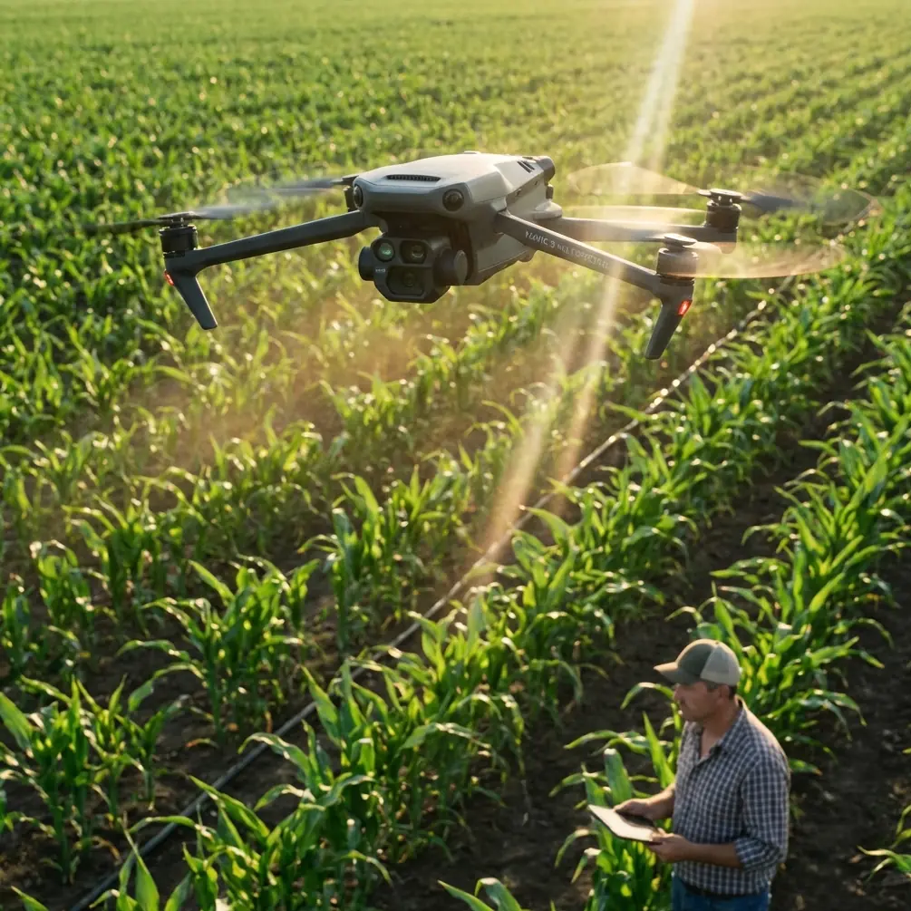
Mavic 3M for Coastal Forest Operations: What Actually Matters in the Field
META: An expert look at how Mavic 3M fits coastal forest and vegetation missions, with practical insight on multispectral workflow, RTK precision, terrain-following logic, spray drift planning, and antenna positioning for reliable range.
Coastal forests punish vague planning.
Salt air, broken canopy, uneven terrain, and unstable weather windows turn a simple drone mission into a chain of small technical decisions. If the aircraft is being used to assess vegetation condition, map planting zones, monitor stress, or support downstream treatment planning, the margin for error narrows quickly. That is where the Mavic 3M becomes interesting—not because it is simply “good for mapping,” but because its value shows up when the mission has to stay precise while the landscape refuses to cooperate.
The wider low-altitude economy story helps explain why this matters now. A recent video series from China’s National Development and Reform Commission framed low-altitude applications through four practical scenes: precision agricultural spraying, intelligent inspection, low-altitude logistics, and public-access flight services. That framing is useful for anyone evaluating the Mavic 3M in forestry. Coastal forest work rarely lives in a single box. One day the task looks like vegetation intelligence. The next, it overlaps with corridor inspection, access planning, or environmental monitoring tied directly to production decisions on the ground. The aircraft is part of a broader operational system, not an isolated camera in the sky.
For coastal forest users, the main question is not whether the Mavic 3M can collect data. It can. The real question is whether it can collect decision-grade data consistently enough that field teams trust it when terrain, wind exposure, and canopy complexity start working against them.
The problem: coastal forests break flat-land assumptions
A lot of drone advice is written as if the earth were level and the target were fully visible. Forest edges near the coast are the opposite. Elevation changes are subtle in some places and abrupt in others. You can move from open access tracks to densely layered canopy in seconds. Wind also behaves differently there. Gusts accelerate through breaks, turbulence forms near tree lines, and the risk of drift or inconsistent coverage rises whenever a mission is linked to spraying or treatment planning.
This is why terrain logic matters even for a platform like the Mavic 3M, which is often discussed primarily through its multispectral payload.
One of the most useful reference points comes from an educational DJI TT exercise that simulates agricultural flight over a sloped tea plantation. The scenario is simple, but the lesson is not. The slope is modeled with a height of 35 centimeters, a right-side slope length of 100 centimeters, a left-side slope length of 50 centimeters, and a width of 120 centimeters. The programmed route uses 30-centimeter spacing between passes while maintaining an 80-centimeter height above the crop. That is an educational exercise, not a field prescription for a Mavic 3M. But operationally, it captures a truth that coastal forest teams ignore at their own expense: the aircraft’s altitude relative to the ground is not the number that matters most. The number that matters is the aircraft’s relationship to the vegetation target.
That distinction affects everything.
If your multispectral mission flies too high above one section of canopy and too low above another, your ground sampling consistency degrades. If your corridor mapping line drifts laterally because the aircraft is fighting crosswind at a ridge edge, your overlap and RTK confidence can suffer. If your operation is part of a larger spray planning workflow, bad terrain handling feeds directly into swath width assumptions and drift risk.
Why the Mavic 3M fits this environment better than a generic mapping workflow
The Mavic 3M earns its place in coastal forestry because it combines mobility with data products that can influence real operational choices. Multispectral capture is the headline feature, but in practice the aircraft’s usefulness comes from the combination of multispectral imaging, RGB context, and centimeter-level positioning workflows when RTK is configured correctly.
That matters in forest work for three reasons.
First, stress detection in coastal vegetation is rarely uniform. Salt exposure, drainage variation, pest pressure, and canopy competition create patchy patterns. A multispectral workflow helps teams move beyond “green equals healthy” assumptions. You are not just documenting appearance; you are comparing reflectance behavior across the site and identifying zones that deserve ground verification.
Second, forests near the coast often support mixed-use land management. A single dataset may inform replanting, thinning, drainage maintenance, access route review, or adjacent asset inspection. That gives the Mavic 3M a practical edge over workflows that produce imagery without strong geospatial discipline. If a weak patch is identified, teams need to return to the same spot, not an approximate area somewhere along a tree line.
Third, forestry decisions are cumulative. One flight rarely settles the issue. Managers need repeatability over time. That is where RTK fix rate and consistent mission geometry become more than technical talking points. A flight done in March needs to align with one repeated in June if you want credible comparisons.
RTK precision is only useful if your range and link discipline are sound
Centimeter precision sounds impressive on paper. In the field, it depends on boring details being handled correctly.
A coastal forest mission can be perfectly designed in software and still underperform if the pilot’s link quality drops at the wrong moment. Trees attenuate signal. Terrain blocks line-of-sight. Moisture and dense foliage do not help. Add long linear routes along shelterbelts, drainage corridors, or coastal access roads, and the radio link becomes part of data quality.
This is where antenna positioning advice stops being a side note and becomes mission-critical.
For the Mavic 3M, maximum practical range in forest work is less about chasing headline distance and more about preserving a clean control and data link across the entire route. The best habit is simple: keep the controller antennas broadside to the aircraft rather than pointed like spears at it. The strongest part of the transmission pattern is generally off the sides of the antennas, not directly off the tips. In practical terms, that means adjusting your stance as the aircraft moves and maintaining open line-of-sight whenever terrain allows. Do not let your own body, a vehicle roof, or a stand of trees become an unnecessary blocker.
In coastal areas, elevation can be your ally. Launch from a slightly elevated clearing when possible, especially if the mission extends beyond the first tree line. Avoid tucking yourself into a hollow or parking beside metal structures that complicate the RF environment. If the route runs along a forest edge, position yourself where the aircraft spends the highest percentage of mission time with the clearest view back to the controller. That is often better than launching from the most convenient road shoulder.
If your team wants mission planning help specific to forest corridors and controller placement, a direct field discussion is usually faster than guessing from screenshots—message our flight support team here.
Terrain-following logic affects more than safety
People often think terrain-following is mainly about avoiding collisions or maintaining legal altitude margins. In vegetation work, its bigger impact is data consistency.
Return to that DJI TT tea garden exercise. The educational mission begins on flat ground, moves forward 30 centimeters into the work area, turns on a green indicator for the simulated spray phase, runs two loops, then exits the area by flying backward 30 centimeters before landing. Again, the scale is classroom-sized, but the operating principle is directly relevant to Mavic 3M missions in coastal forests: transitions into and out of the target zone need to be deliberate, and the active work segment should be spatially controlled.
For forestry mapping, that means identifying where useful data collection truly begins and where it ends. Do not clutter datasets with unnecessary transition segments over roads, ponds, or exposed sand patches unless they matter to the analysis. Define overlap, speed, and altitude around the biological target, not around the convenience of takeoff.
The same principle matters when the Mavic 3M supports planning around spray drift. While the aircraft itself is not a spray platform, multispectral and RGB data often inform where treatment may later occur. If your mapping pass does not respect terrain-driven canopy changes, the treatment map built from that data can mislead downstream operators. Incorrect vigor interpretation may lead to wrong nozzle calibration assumptions, poor swath width planning, or unnecessary repeat treatment.
Spray drift starts long before the sprayer takes off
This is the part many teams miss.
By the time an agronomy or vegetation-management crew discusses spray drift, the operational error may already have happened at the data collection stage. Coastal environments amplify this risk because wind behaves unpredictably at forest margins and over broken ground. If the Mavic 3M is being used to map vegetation health before remediation or targeted application, the mission must capture boundaries, canopy density differences, and slope transitions cleanly enough that subsequent planning reflects reality.
That is why broad references to “precision spraying” in the low-altitude economy discussion are relevant here. Precision is not only a matter of atomization and nozzles. It starts with correct spatial intelligence.
A forest manager evaluating treatment zones near a coastal windbreak needs to know where vigor drops sharply, where canopy opens, and where access routes constrain machinery or spray approaches. Multispectral outputs can support those decisions, but only if the operator has controlled speed, overlap, and positional confidence. Fast flights that look efficient can be expensive later if the data obscures edge effects or misses stress pockets under changing light.
Inspection logic also belongs in forest operations
The same policy video series that highlighted precision spraying also called out intelligent inspection. For coastal forests, that matters more than it first appears.
Inspection is not just about powerlines and industrial assets. Forest operations involve culverts, embankments, roads, drainage features, fencing, planted rows, and shoreline-adjacent infrastructure. The Mavic 3M becomes more valuable when operators stop treating multispectral work and visual inspection as separate universes. A degraded patch in vegetation may be linked to drainage failure. A stressed shelterbelt may correlate with saltwater intrusion or blocked runoff. RGB context gives field teams a visual narrative; multispectral data gives them a measurable pattern.
This is where the Mavic 3M fits the “problem-solution” model well. The problem is not merely “we need maps.” The problem is fragmented situational awareness. Different teams often inspect, map, and treat the same area using disconnected methods. The solution is a workflow in which one flight can flag biological stress, support repeatable geolocation, and give operations staff imagery they can actually act on.
What operators should focus on before the next mission
For coastal forest missions with the Mavic 3M, the best results usually come from tightening five things:
1. Define the biological target, not just the polygon
Are you monitoring canopy stress, replant survival, salt exposure, drainage impact, or corridor encroachment? Mission settings should reflect that purpose.
2. Build altitude around canopy relationship
The tea-slope training example’s 80-centimeter crop separation illustrates the core principle: maintain a consistent relationship to the vegetation, not just to sea level or takeoff point.
3. Protect RTK quality through route design
A strong RTK fix rate is easier to maintain when flight lines avoid unnecessary shielding from terrain or dense tree masses near the pilot position.
4. Treat antenna orientation as a data-quality tool
Poor antenna alignment does not just threaten control confidence. It can interrupt mission smoothness and affect repeatability, especially on linear forest-edge routes.
5. Think downstream
If the output will feed treatment planning, drift management, nozzle calibration decisions, or swath width assumptions, collect the data like those later decisions depend on it—because they do.
The Mavic 3M is not magic. It does not erase coastal wind, slope, or canopy complexity. What it does offer is a disciplined way to turn those variables into usable information—provided the operator respects terrain, link management, and the difference between flying a route and capturing decision-grade evidence.
That is the real standard in forest work. Not whether the aircraft completes the mission, but whether the mission stands up when the ground team starts asking hard questions.
Ready for your own Mavic 3M? Contact our team for expert consultation.