Mavic 3M for Solar Farms in Low Light: The Flight Altitude
Mavic 3M for Solar Farms in Low Light: The Flight Altitude Choice That Changes Everything
META: Practical Mavic 3M guidance for solar farm operations in low light, with expert insight on flight altitude, route control, multispectral reliability, and precision workflow setup.
Low-light work at a solar farm exposes every weak habit in a drone workflow.
It is not usually the aircraft that fails first. It is the plan. Pilots launch too low and lose efficiency. They launch too high and sacrifice the fidelity needed to catch subtle anomalies. They focus on the camera payload and forget the geometry of the pass. Then the data comes back inconsistent, especially across long rows of panels where repeatability matters more than a single impressive image.
For Mavic 3M operators, that is where the real conversation should start: not with a feature checklist, but with how to hold a clean, repeatable flight path when visibility is reduced and the site itself creates visual monotony. Solar farms look simple from the ground. In practice, they challenge orientation, line discipline, and mission consistency.
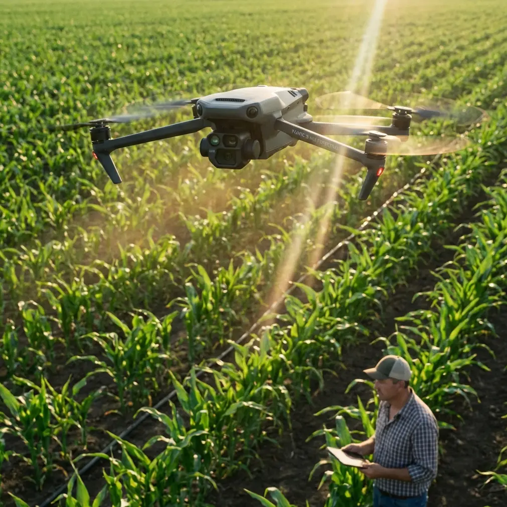
The Mavic 3M is a strong fit for this kind of civilian commercial work because it combines multispectral capability with precision-oriented mapping workflows. But if your use case is delivering data over a solar site in low light, one variable deserves more respect than it usually gets: flight altitude.
Why altitude is the first real decision
Many teams treat altitude as a box to fill in before takeoff. That is backwards.
Altitude controls swath width, image overlap behavior, ground sampling detail, mission duration, and how forgiving the operation will be when ambient light is weak. On a solar farm, it also affects how consistently you can track row geometry across hundreds or thousands of modules that look nearly identical from above.
Fly too low, and you may get excellent detail on individual modules while creating a fragile mission. Narrow swath width means more passes. More passes mean more turns. More turns create more opportunities for small alignment errors, especially when the pilot’s visual references are weaker in dawn, dusk, haze, or overcast conditions.
Fly too high, and the mission becomes efficient on paper while the imagery loses some of the practical texture needed for downstream interpretation. The right altitude is rarely the highest or lowest the aircraft can handle. It is the one that balances repeatability, usable multispectral data, and manageable turn count.
That last point matters more than most pilots realize.
The route problem hidden inside low-light solar missions
A useful clue comes from classic RC flight training rather than enterprise marketing. One training principle says the pilot should keep asking a simple question: “Where is the aircraft flying relative to me?” Another emphasizes that if the aircraft exits a turn in the wrong place, the smarter correction is often to adjust the start point of the turn rather than forcing a bad line afterward.
That sounds basic. It is not.
On a solar farm in low light, your eyes can be fooled by repetitive panel rows and low-contrast terrain. The site offers fewer natural visual anchors than orchards, mixed fields, or built-up industrial yards. If the turn initiation point drifts, the whole next leg can drift with it. By the time the deviation is obvious, you have already compromised overlap or wasted time correcting.
This is why altitude choice and route discipline are tied together. A slightly higher mission altitude can reduce the number of turns required across a large block of arrays because it increases effective swath width. Fewer turns generally mean fewer opportunities to enter the next line with a skewed setup. That alone can improve consistency more than many operators expect.
The training logic is simple: if the exit is wrong, inspect the entry. In mapping terms, if your passes are irregular, review where and how the aircraft is beginning each turn, not just what happened mid-leg.
A practical altitude approach for Mavic 3M on solar farms
For low-light solar work, I usually advise operators to think in bands rather than one universal number.
A lower band is useful when the mission goal is defect-level scrutiny in selected sections, particularly where the site has known problem strings or specific maintenance questions. A mid-altitude band is usually the better default for whole-site coverage because it protects line consistency while still delivering solid data density. A higher band can make sense for rapid baseline mapping or progress documentation, but it should be chosen carefully if the end user expects fine anomaly interpretation from multispectral outputs.
The mistake is chasing theoretical maximum detail when the actual mission needs dependable, repeatable data across a large and visually repetitive site.
For many solar farm operations, the best altitude is the one that gives you enough module-level clarity while still widening the swath enough to reduce needless turns. In low light, I lean toward that middle ground. The mission becomes calmer. The geometry improves. The operator spends less energy correcting course and more energy confirming the aircraft is holding the plan.
That is operationally significant because low-light work already narrows your margin. You do not want to spend that margin on avoidable turning errors.
What airflow physics quietly teaches us about drone planning
An unusual but relevant lesson comes from an educational drone text explaining the Coandă effect. In the candle-and-glass experiment, air does not simply stop when it meets the cup. Instead, because of surface-following airflow behavior and a low-pressure region near the curved wall, the stream bends and travels along the outside of the glass to reach the flame. The source notes this through diagrams showing airflow splitting around the cup, low pressure near the surface, and the stream curving toward that region. It also ties the explanation to Bernoulli’s principle, citing Daniel Bernoulli’s 1726 work on the relationship between flow speed and pressure.
Why bring that into a Mavic 3M solar discussion?
Because low-light flights around large panel fields are often affected by local airflow behavior near rows, inverter blocks, perimeter fencing, and service structures. I am not suggesting a pilot model every pressure pocket before takeoff. I am saying this: airflow does not always behave the way a quick glance suggests. Surface-induced flow changes can create subtle disturbances near obstacles, particularly when flying lower and closer to site infrastructure.
That makes altitude selection even more important. A mission flown unnecessarily low can be more exposed to local turbulence effects that are irrelevant at a slightly higher, cleaner operating layer. If your objective is stable multispectral capture, there is no advantage in hugging the site closer than necessary. The better choice is often the altitude that keeps the aircraft out of fussy local air while preserving the data resolution the inspection actually needs.
That is a direct operational takeaway from a seemingly simple physics lesson.
Multispectral consistency matters more than dramatic imagery
With the Mavic 3M, the point of multispectral capture is not to create visually striking pictures. It is to generate interpretable, repeatable information.
On a solar farm, that usually means comparing sections, tracking change over time, identifying underperforming zones, and aligning findings with field maintenance workflows. In low light, repeatability is everything. If one flight is performed at a poorly chosen altitude with erratic line spacing and another is flown more cleanly a week later, apparent differences may reflect collection quality rather than actual site change.
That is where centimeter precision and RTK Fix rate deserve attention. Precision is not just a map-quality bragging point. On solar sites, it supports confident revisit missions over the same rows and equipment blocks. If the RTK solution is stable, and the mission altitude is selected to keep overlap and leg alignment under control, the resulting dataset becomes much more useful for comparison work.
This is also where nozzle calibration and spray drift, though more often associated with agriculture, offer a useful mental model. In spraying, poor calibration ruins consistency before the aircraft even leaves the field. Drift then carries material away from where it was intended to go. In mapping, the equivalent failures are poor mission setup and lateral inconsistency. If your line plan is sloppy, the payload cannot rescue the output. Precision begins before the first image is captured.
The low-light workflow I recommend
For solar operators using Mavic 3M, I recommend a disciplined problem-solution workflow:
1. Define the inspection question before choosing altitude
Are you documenting broad site condition, comparing multispectral variation across blocks, or checking a known issue area? Whole-site baseline work generally benefits from a moderate altitude that improves swath width and reduces turn count. Targeted diagnostics can justify going lower.
2. Use visible site references, not assumptions
The RC training principle of using yourself as a reference is still valuable in modern commercial operations. On-site, translate that idea into stable reference thinking: where is the aircraft relative to the intended corridor, the array edge, and the next turn point? Do not wait until the drift is obvious.
3. Adjust turn entry, not just turn behavior
If the aircraft repeatedly exits turns misaligned, revise where the turn begins. This comes straight from the training source and has real value on repetitive solar layouts. Small setup changes can remove recurring line errors without overcorrecting the aircraft during the arc.
4. Avoid flying lower than the data requirement demands
The Coandă-effect lesson is a reminder that local airflow near surfaces and structures can be less predictable than open air. If your Mavic 3M can deliver the required ground detail from a cleaner altitude band, take the cleaner band.
5. Watch RTK performance as a workflow metric, not a spec sheet line
A strong RTK Fix rate supports confidence in repeat missions and spatial consistency between datasets. On a solar farm, that matters when teams are trying to validate whether a change is real or just a collection artifact.
6. Build one repeatable template and refine it
The best operators do not reinvent every mission. They establish a site-ready template for overlap, altitude, speed, and turn handling, then tweak only what the day requires.
So what is the optimal altitude?
If you want a hard number, the honest answer is that it depends on panel layout, required output detail, ambient light, and the scale of the site. But for low-light solar delivery, the strongest default is usually not the minimum altitude that still “works.” It is the moderate altitude that preserves multispectral usefulness while widening coverage enough to improve route stability and reduce excess turns.
That is the altitude where the Mavic 3M becomes more than a sensor platform. It becomes a reliable measurement tool.
If you are managing a large site, that reliability will save more time than squeezing out a little extra theoretical detail from an overly low pass. Better line discipline, cleaner overlap, and more consistent revisit performance tend to beat aggressive low-altitude flying over the long run.
And if your team is tuning a workflow for a specific solar layout, it can help to compare mission settings with someone who has already seen how these trade-offs play out in the field. If you want to discuss route setup, altitude bands, or multispectral mission design for your site, you can message Marcus directly on WhatsApp.
The real advantage of Mavic 3M on solar farms
The Mavic 3M is not interesting because it can fly a mission. Many platforms can do that.
What matters is that it can support a disciplined, repeatable inspection method when conditions are less forgiving. Low light strips away casual piloting habits. It punishes vague route planning. It exposes every weak turn, every poor entry point, every altitude choice made without thinking through swath width and data consistency.
That is why the best Mavic 3M results on solar farms do not come from flying lower just because you can. They come from understanding the mission geometry, respecting atmospheric behavior around structures, and using precision tools the way they were meant to be used.
A drone mission is not only about what the sensor sees. It is about how predictably the aircraft arrives at every point where the sensor needs to see it.
Ready for your own Mavic 3M? Contact our team for expert consultation.