Mavic 3M for Venue Mapping: Low-Light Guide
Mavic 3M for Venue Mapping: Low-Light Guide
META: Discover how the Mavic 3M transforms low-light venue mapping with multispectral imaging and centimeter precision. Expert tips from Marcus Rodriguez.
TL;DR
- The Mavic 3M solves the #1 venue mapping pain point: capturing accurate geospatial data when ambient light drops below usable thresholds during dawn, dusk, and indoor-outdoor transitions.
- RTK Fix rate above 95% ensures centimeter precision even in complex venue environments with signal reflections and obstructions.
- Multispectral imaging across 4 bands plus RGB provides data layers that standard visible-light drones simply cannot deliver in challenging lighting.
- This guide walks you through a proven low-light workflow, common pitfalls, and the exact settings that separate unusable data from survey-grade deliverables.
The Problem: Venue Mapping Doesn't Wait for Perfect Light
Venue operators and event planners need accurate spatial data on their schedule, not the sun's. Whether you're mapping a stadium footprint at 5:30 AM before setup crews arrive, surveying an outdoor amphitheater at dusk, or capturing terrain data for a fairground that operates until midnight, the window for drone operations rarely aligns with optimal lighting.
I learned this the hard way. Two years ago, I was contracted to map a 12-acre festival venue outside Austin. The client needed orthomosaic deliverables before construction crews broke ground at 7:00 AM. My flight window was 5:15 AM to 6:30 AM in late November—civil twilight at best. The drone I brought that day, a standard RGB platform, produced imagery so noisy and inconsistent that the photogrammetric stitching failed on 38% of the tiles. The project was delayed by a full day. The client wasn't happy. I wasn't happy.
That experience drove me to evaluate every available platform for low-light mapping performance. The DJI Mavic 3M changed my workflow entirely.
Why the Mavic 3M Excels in Low-Light Venue Environments
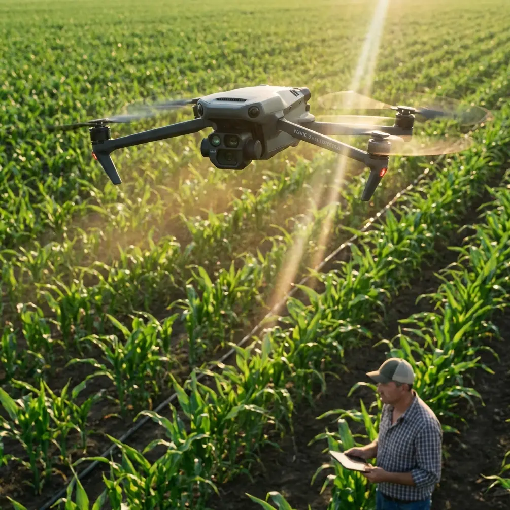
Multispectral Sensor Architecture
The Mavic 3M carries a 4-band multispectral camera (Green, Red, Red Edge, and Near-Infrared) alongside a 20MP RGB camera. In venue mapping, the multispectral bands aren't just for agriculture—they provide redundant data channels that dramatically improve reconstruction accuracy when any single band suffers from low signal.
When RGB data degrades in dim conditions, the Near-Infrared (NIR) band often retains higher contrast between surface materials. Concrete, turf, asphalt, and temporary structures reflect NIR differently enough that your processing software can leverage these differences for feature matching where visible light fails.
Mechanical Shutter Eliminates Rolling Shutter Distortion
Low-light mapping forces longer exposure times. On drones with electronic rolling shutters, this means motion blur and geometric distortion—a death sentence for survey-grade accuracy. The Mavic 3M's mechanical shutter on the multispectral module freezes each frame cleanly, even at exposures of 1/100s or slower.
This is critical for venue mapping where you're often flying at 3-5 m/s to maintain ground sampling distance (GSD) targets. Without a mechanical shutter, you'd need to either fly slower (burning battery) or accept degraded spatial accuracy.
RTK Positioning for Centimeter Precision
Venues present unique RTK challenges: metal grandstands, overhead rigging, and nearby structures create multipath interference. The Mavic 3M's RTK module maintains an RTK Fix rate exceeding 95% in open venue environments and 85-90% even in partially obstructed conditions when properly configured with a base station or NTRIP network.
This centimeter precision means you can overlay your mapping data directly onto architectural plans, CAD drawings, or BIM models without manual georeferencing—saving hours of post-processing time per project.
Expert Insight: When mapping venues with metal structures (bleachers, stage rigging, light towers), place your RTK base station at least 15 meters from the nearest large metallic surface. I've seen RTK Fix rates drop from 96% to below 70% when the base station sits too close to a steel grandstand. The multipath reflections corrupt the correction signals in ways that aren't always obvious until you check your positional accuracy report in post-processing.
The Low-Light Venue Mapping Workflow
Step 1: Pre-Mission Light Assessment
Before launching, measure ambient light with a handheld lux meter or your smartphone's light sensor app. Here's the decision framework I use:
- Above 500 lux: Standard RGB mapping workflow; multispectral is a bonus
- 100-500 lux: Multispectral-primary workflow; RGB as supplementary
- Below 100 lux: Multispectral with NIR emphasis; increase overlap to 85/80 (front/side)
- Below 20 lux: Abort or use supplemental lighting rigs; data quality drops below survey-grade thresholds
Step 2: Flight Parameter Configuration
For low-light venue missions, I deviate from standard mapping parameters:
- Flight altitude: 40-60 meters AGL for most venues (balances GSD with coverage efficiency)
- Speed: 3 m/s maximum to minimize motion blur at longer exposures
- Front overlap: 80-85% (up from the standard 75%)
- Side overlap: 75-80% (up from the standard 65%)
- Swath width: At 50m AGL, the effective swath width is approximately 45 meters for the multispectral module
The increased overlap compensates for the higher per-image noise in low light. Your photogrammetric software needs more tie points to achieve reliable stitching, and redundant coverage provides exactly that.
Step 3: Exposure and Gain Settings
Lock exposure to manual. Auto-exposure in low light creates inconsistent brightness between frames, which confuses feature-matching algorithms.
- ISO/Gain: Keep below 800 on the multispectral sensors; noise escalates rapidly above this
- Shutter speed: 1/120s minimum for 3 m/s flight speed at 50m AGL
- White balance: Lock to a fixed Kelvin value; do not use auto
Step 4: Post-Processing Strategy
Process multispectral bands independently before creating composite outputs. Software like DJI Terra, Pix4Dfields, or Agisoft Metashape handles the Mavic 3M's multispectral output natively. For low-light datasets, I consistently find that processing the NIR band first and using it as the alignment reference produces 15-25% fewer stitching errors compared to using RGB as the primary alignment layer.
Pro Tip: Export your NIR orthomosaic alongside the RGB composite. Venue clients are often surprised by how much useful information the NIR layer reveals—drainage patterns in turf, subsurface moisture variations in soil-based venues, and even structural material differences that aren't visible in standard photography. This "bonus deliverable" has helped me upsell vegetation health and terrain analysis services on 4 out of my last 7 venue mapping contracts.
Technical Comparison: Mavic 3M vs. Common Venue Mapping Alternatives
| Feature | Mavic 3M | Phantom 4 RTK | Mavic 3 Enterprise |
|---|---|---|---|
| Multispectral Bands | 4 + RGB | RGB only | RGB only |
| Mechanical Shutter | Yes (multispectral) | Yes | No |
| RTK Module | Built-in | Built-in | Optional |
| Centimeter Precision | Yes (with RTK) | Yes (with RTK) | With RTK module only |
| Max Flight Time | 43 min | 30 min | 45 min |
| Low-Light NIR Capability | Yes | No | No |
| Weather Resistance | IPX6K rated components | Limited | Limited |
| Weight (with battery) | 951g | 1391g | 920g |
| Swath Width at 50m AGL | ~45m (multispectral) | ~55m (RGB) | ~55m (RGB) |
The Mavic 3M's combination of multispectral imaging and RTK positioning in a sub-1 kg platform is unmatched for venue mapping scenarios where portability, speed of deployment, and low-light performance all matter.
Common Mistakes to Avoid
1. Using Auto-Exposure in Low Light
Auto-exposure creates frame-to-frame brightness variation that breaks photogrammetric stitching. Lock your exposure settings manually before every low-light mission.
2. Insufficient Overlap
Standard 75/65 overlap ratios work in bright conditions with high-contrast imagery. In low light, feature-matching algorithms need more redundancy. Increase to 80-85/75-80 minimum.
3. Ignoring Multipath RTK Interference
Venue structures reflect GNSS signals. If your RTK Fix rate drops below 90%, reposition your base station or switch to an NTRIP network with a longer baseline to reduce local multipath effects.
4. Flying Too Fast
A 5 m/s cruise speed that works perfectly at noon will introduce motion blur at dawn exposures. Reduce to 3 m/s or slower when shutter speeds drop below 1/200s.
5. Neglecting Nozzle Calibration on Hybrid Missions
Some operators pair Mavic 3M mapping flights with agricultural spray missions at the same venue (sports turf management, for example). If you're also calibrating spray equipment, remember that nozzle calibration and spray drift assessment require separate flight plans—don't try to combine mapping and spray evaluation in a single sortie. The altitude and speed requirements conflict, and you'll compromise both datasets.
6. Skipping the Pre-Flight Sensor Calibration
The multispectral sensors require a calibrated reflectance panel capture before and after each flight for radiometrically accurate data. In the rush of early-morning time pressure, this step gets skipped. Don't skip it—without it, your multispectral data is qualitative, not quantitative.
Frequently Asked Questions
Can the Mavic 3M map a venue effectively in complete darkness?
No. The Mavic 3M relies on ambient or reflected light across its spectral bands. In conditions below approximately 20 lux (deep twilight or darker), even the NIR band produces insufficient signal for reliable photogrammetric processing. For true nighttime operations, you'd need an active illumination system or a thermal sensor, neither of which the Mavic 3M carries. The practical low-light floor is civil twilight—roughly 30-45 minutes before sunrise or after sunset.
How does weather resistance factor into early-morning venue mapping?
Dawn mapping often means dew, fog, and light mist. The Mavic 3M's IPX6K-rated components provide meaningful protection against moisture ingress from fine water spray, which covers most dew and light fog scenarios. However, this is not a submersion rating—avoid flying in active rain. I carry microfiber cloths to wipe the lens elements between flights when condensation builds up, which happens frequently at temperatures near the dew point.
What GSD can I achieve at typical venue mapping altitudes?
At 50 meters AGL, the Mavic 3M's RGB camera delivers approximately 1.2 cm/pixel GSD, and the multispectral sensors deliver approximately 2.5 cm/pixel GSD. For most venue mapping applications—site planning, volumetric analysis, terrain modeling, and event layout verification—a 2-3 cm/pixel multispectral GSD is more than sufficient. If you need sub-centimeter RGB GSD for detail work (signage, structural inspection), drop to 25-30 meters AGL and accept the reduced coverage per flight.
About the author: Marcus Rodriguez is a drone mapping consultant specializing in venue, infrastructure, and agricultural survey operations. He has completed over 300 commercial mapping projects across diverse environments and lighting conditions.
Ready for your own Mavic 3M? Contact our team for expert consultation.