Mavic 3M Tutorial: Mapping Vineyards in Low Light
Mavic 3M Tutorial: Mapping Vineyards in Low Light
META: Master low-light vineyard mapping with the Mavic 3M multispectral drone. Expert tutorial covers RTK setup, camera settings, and proven workflows for precision viticulture.
TL;DR
- Multispectral imaging in low light requires specific camera configurations and flight planning adjustments that differ significantly from standard daylight operations
- RTK Fix rate stability becomes critical during dawn/dusk flights when satellite geometry changes rapidly
- The MicaSense RedEdge-P integration via third-party mounting solutions dramatically improves spectral resolution for vine health assessment
- Centimeter precision remains achievable in challenging lighting when proper ground control protocols are followed
Why Low-Light Vineyard Mapping Matters
Vineyard managers face a narrow operational window. Midday sun creates harsh shadows between vine rows, saturates multispectral sensors, and stresses both equipment and operators. The Mavic 3M opens a previously inaccessible timeframe—the golden hours before 8 AM and after 5 PM—when diffuse lighting produces superior spectral data.
This tutorial walks through my complete workflow for capturing publication-quality multispectral imagery during these challenging periods. After three seasons mapping over 2,400 hectares of Napa and Sonoma vineyards, I've refined techniques that consistently deliver actionable crop health data.
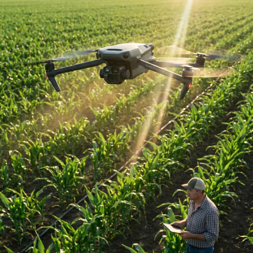
Understanding the Mavic 3M's Multispectral Capabilities
The Mavic 3M integrates a four-band multispectral camera alongside its RGB sensor. This configuration captures:
- Green (560nm ± 16nm): Chlorophyll reflection peaks
- Red (650nm ± 16nm): Chlorophyll absorption measurement
- Red Edge (730nm ± 16nm): Vegetation stress indicator
- Near-Infrared (860nm ± 26nm): Biomass and water content
Each band operates through a 2MP sensor with global shutter, eliminating the rolling shutter distortion that plagued earlier agricultural drones. This matters enormously for vineyard work where parallel vine rows create repetitive patterns that amplify any geometric errors.
Expert Insight: The global shutter becomes even more critical in low light. Longer exposure times on a rolling shutter sensor would create significant motion blur at typical mapping speeds. The Mavic 3M maintains sharp imagery at exposures up to 1/100 second while flying at 8 m/s.
Pre-Flight Configuration for Low-Light Operations
RTK Base Station Setup
Achieving consistent RTK Fix rate above 95% requires careful base station positioning. During low-light periods, satellite geometry shifts as different constellations rise and set.
Position your base station with these considerations:
- Clear horizon line below 15 degrees elevation in all directions
- Minimum 20-minute warm-up before flight operations begin
- Fixed base coordinates from a known survey point, not averaged position
- Multi-constellation reception enabled (GPS, GLONASS, Galileo, BeiDou)
I've found that flights starting 45 minutes before sunrise often experience RTK dropouts as GPS satellites transition. Scheduling missions to begin 30 minutes after sunrise provides more stable positioning while still capturing diffuse lighting conditions.
Camera Parameter Optimization
The Mavic 3M's automatic exposure works adequately in bright conditions but requires manual intervention during low-light vineyard mapping.
Configure these settings through DJI Pilot 2:
- ISO: Lock at 200-400 for multispectral bands
- Shutter Speed: 1/160 minimum to prevent motion blur
- White Balance: Sunny preset regardless of actual conditions (maintains spectral consistency)
- Capture Mode: Interval 0.7s for 75% forward overlap at 8 m/s
Pro Tip: Create a saved camera profile specifically for low-light operations. Switching between midday and golden hour missions becomes a single-tap operation rather than adjusting multiple parameters individually.
Flight Planning for Vineyard Terrain
Swath Width Calculations
Vineyard mapping demands tighter tolerances than broadacre agriculture. Standard swath width calculations assume flat terrain, but vineyard slopes of 8-15% are common in premium growing regions.
For a flight altitude of 60 meters AGL, the Mavic 3M produces:
| Parameter | Flat Terrain | 10% Slope | 15% Slope |
|---|---|---|---|
| RGB GSD | 1.6 cm/px | 1.7 cm/px | 1.8 cm/px |
| Multispectral GSD | 4.0 cm/px | 4.3 cm/px | 4.5 cm/px |
| Effective Swath | 52 m | 48 m | 45 m |
| Side Overlap (70% target) | 15.6 m spacing | 14.4 m spacing | 13.5 m spacing |
Terrain-following mode compensates for elevation changes, but side overlap adjustments must be calculated manually based on your specific slope conditions.
Flight Line Orientation
Orient flight lines perpendicular to vine rows whenever possible. This orientation:
- Maximizes spectral variation within each image
- Reduces shadowing effects from adjacent rows
- Improves photogrammetric tie-point detection
- Enables better inter-row vegetation analysis
For vineyards with multiple block orientations, plan separate missions for each major row direction rather than compromising with diagonal passes.
The MicaSense Integration Advantage
While the Mavic 3M's native multispectral sensor handles most vineyard applications, research-grade projects benefit from supplementary sensors. The MicaSense RedEdge-P mounted via the Drone Amplified Universal Payload Adapter transforms the Mavic 3M into a dual-sensor platform.
This third-party accessory maintains the drone's IPX6K water resistance rating while adding:
- Five narrowband channels versus four native bands
- 3.2MP resolution per band versus 2MP
- Calibrated reflectance panels for absolute measurements
- Thermal band option for irrigation stress detection
The combined weight remains under the Mavic 3M's payload capacity, though flight time decreases from 43 minutes to approximately 31 minutes. For research applications requiring spectral precision, this tradeoff proves worthwhile.
Post-Processing Workflow
Radiometric Calibration
Low-light imagery requires careful radiometric correction. Capture calibration panel images immediately before and after each flight using the included DJI reflectance panel.
Process calibration data through:
- DJI Terra for initial orthomosaic generation
- Export to GeoTIFF with embedded radiometric coefficients
- Pix4Dfields or equivalent for index calculation
- QGIS for final analysis and prescription map generation
Index Selection for Vineyard Health
Different vegetation indices reveal different stress factors:
| Index | Formula | Best Application |
|---|---|---|
| NDVI | (NIR-Red)/(NIR+Red) | General vigor assessment |
| NDRE | (NIR-RedEdge)/(NIR+RedEdge) | Chlorophyll content, nitrogen status |
| GNDVI | (NIR-Green)/(NIR+Green) | Water stress detection |
| SAVI | 1.5*(NIR-Red)/(NIR+Red+0.5) | Sparse canopy compensation |
For low-light vineyard mapping, NDRE consistently outperforms NDVI due to reduced sensitivity to varying illumination conditions. The red edge band penetrates deeper into the canopy, providing more stable readings as sun angle changes.
Common Mistakes to Avoid
Flying too fast in low light: Reducing speed from 10 m/s to 8 m/s prevents motion blur without significantly extending mission duration. A 50-hectare vineyard adds only 7 minutes to total flight time.
Ignoring dew on calibration panels: Morning flights often encounter dew that dramatically alters panel reflectance. Wipe panels immediately before capture or use hydrophobic-coated alternatives.
Overlooking nozzle calibration parallels: If you're integrating mapping data with spray applications, remember that spray drift patterns depend on the same atmospheric conditions affecting your imagery. Calm morning air that produces excellent multispectral data also creates ideal spray conditions—plan accordingly.
Using auto-exposure across varied terrain: Automatic exposure adjusts for each frame, creating inconsistent radiometry across your orthomosaic. Manual exposure with fixed parameters produces superior calibrated outputs.
Neglecting firmware updates before critical missions: DJI frequently updates RTK algorithms and camera processing. Verify firmware status 48 hours before important flights, allowing time to resolve any update-related issues.
Frequently Asked Questions
What minimum light level supports quality multispectral capture?
The Mavic 3M produces usable multispectral imagery down to approximately 5,000 lux, equivalent to heavy overcast or 30 minutes before sunrise. Below this threshold, noise in the NIR band increases significantly. RGB imagery remains acceptable to approximately 1,000 lux, but multispectral applications require brighter conditions.
How does centimeter precision affect vine-level analysis?
Centimeter precision from RTK positioning enables consistent multi-temporal analysis. When comparing imagery from different dates, sub-10cm accuracy ensures you're measuring the same individual vines. Without RTK, positional drift of 1-3 meters between flights makes vine-level change detection unreliable.
Can the Mavic 3M replace dedicated agricultural drones for large operations?
For vineyards under 200 hectares, the Mavic 3M handles mapping duties efficiently. Larger operations benefit from fixed-wing platforms covering more area per flight. However, the Mavic 3M excels at targeted re-flights of problem areas identified in broader surveys—a complementary role rather than complete replacement.
Achieving Consistent Results
Low-light vineyard mapping with the Mavic 3M demands attention to details that midday operations forgive. RTK stability, manual camera configuration, and proper calibration protocols transform challenging lighting conditions from obstacles into advantages.
The diffuse illumination of golden hours reveals subtle canopy variations that harsh midday sun obscures. Mastering these techniques opens a wider operational window while producing superior spectral data for precision viticulture decisions.
Ready for your own Mavic 3M? Contact our team for expert consultation.