Mavic 3M for Remote Highway Monitoring: Field Methods That
Mavic 3M for Remote Highway Monitoring: Field Methods That Matter More Than Spec Sheets
META: A practical expert article on using Mavic 3M for remote highway monitoring, with field safety, pre-flight workflow, interference checks, and lessons drawn from commercial UAV transport and civil monitoring operations.
Remote highway corridors are unforgiving places to run a drone mission badly.
You are often dealing with long linear assets, uneven terrain, few recovery options, patchy signal environments, and a worksite culture where one overlooked step can ripple into lost data or an aborted sortie. That is exactly why the Mavic 3M deserves to be discussed as an operational tool, not just as a multispectral aircraft on a product page.
For highway monitoring in remote areas, the real question is not whether the aircraft can fly. It is whether the team around it can produce reliable, repeatable, defensible data while controlling risk. The best practices are not abstract. They show up in how you pack the aircraft, how you inspect the launch area, how you test for interference, how you document each flight, and even how you clean sensors before takeoff.
That last point sounds small. It is not.
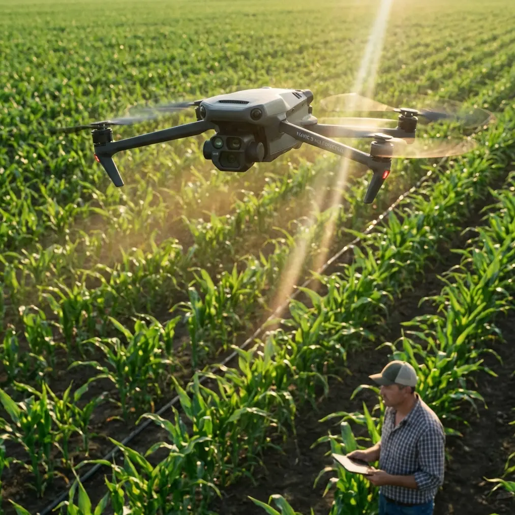
The overlooked pre-flight cleaning step that protects the entire mission
Before I talk about route design or corridor coverage, I want to start with a basic habit that too many crews rush past: cleaning the aircraft’s sensing and safety surfaces before launch.
On a remote highway project, dust is constant. Fine grit settles on obstacle sensing windows, camera glass, airframe seams, battery contacts, landing surfaces, and case foam. If a drone has been transported over rough roads, that debris can combine with vibration residue and create small failures that are easy to misread later as software or signal issues.
A proper pre-flight cleaning step is not cosmetic. It directly supports the safety systems you are trusting over a long corridor mission. Wipe optical surfaces with the right material. Check for residue near vents. Confirm the battery interface is clean and fully seated. Inspect the landing gear area for pebbles or plant matter. If you are operating after a previous agricultural or dusty industrial mission, be especially careful about contamination carried over from transport.
This discipline aligns with a larger truth from field operations: equipment protection starts before takeoff. One of the reference operating documents stresses that aircraft, equipment, and tools should be arranged and secured properly during transport to avoid compression, impact, and damage. That is not a logistics footnote. For a Mavic 3M team driving into remote highway sections, transport abuse is one of the most common hidden causes of later performance anomalies.
A drone can leave the office “ready,” then arrive at the site with shifted components, dirty sensors, or battery stress from poor storage. If the launch team skips cleaning and inspection, they are building uncertainty into every image and every flight decision that follows.
Remote highway monitoring is a corridor problem, not a point-capture problem
Many new operators approach highway work as if it were a collection of isolated photos. It is not. Highway monitoring is a corridor problem. You need continuity.
That matters because the value of Mavic 3M in this setting is not limited to what it sees in one frame. It is in how the mission can stitch together conditions across a long route: shoulder erosion, drainage issues, slope instability, vegetation encroachment, runoff pathways, culvert blockage, ponding near embankments, and changes at access roads or bridge approaches.
A useful parallel comes from water conservancy monitoring. In the reference material, UAV imagery was used not just to capture a river at one moment, but to compare change over time. One case showed that a river channel shifted from north to south over a four-year period from 2010 to 2014. That kind of time-series interpretation is exactly the mindset highway teams need. The drone is not merely documenting what exists today. It is helping determine what is changing, where, and how fast.
For a remote highway operator, that can mean comparing repeated corridor datasets to identify:
- expanding washout risk near embankments
- progressive shoulder deformation
- vegetation spread affecting line of sight or maintenance access
- recurring water accumulation after seasonal events
- construction disturbance around adjacent utility or drainage features
The Mavic 3M’s value grows when crews design flights around repeatability. Same corridor logic. Similar height bands when appropriate. Consistent overlap. Stable documentation. Clean records.
Without that consistency, you still get images. You just do not get strong operational evidence.
Site reconnaissance is not optional, even with a smart aircraft
A well-equipped drone does not remove the need for site judgment.
One of the strongest points in the field operations reference is the requirement to study the site after arrival: identify takeoff and landing areas, planned travel routes, obstacles, and possible signal or magnetic interference, then conduct a range check to confirm a clean environment. That sequence is deeply relevant for remote highway monitoring with Mavic 3M.
Highways attract interference sources and physical hazards in a way open farmland often does not. You may have:
- overhead power lines
- roadside metal structures
- vehicles entering and leaving the zone
- terrain breaks that affect signal geometry
- culvert depressions and embankments that complicate visual awareness
- temporary construction machinery
- telecommunications equipment near service corridors
The water monitoring reference offers a useful example here too. In that project, aerial imagery identified power lines crossing above the river corridor, and the analysis was used to flag safety concerns requiring focused monitoring. Translate that to a highway environment and the lesson is direct: aerial data is useful not only for asset observation but also for exposing hazards to future operations and maintenance teams.
This is where the Mavic 3M fits well operationally. It can become both the observation platform and the planning instrument for the next site visit. But only if the crew first respects the field environment and verifies it properly.
A remote corridor mission should begin with a walk, not a launch.
Why documentation separates disciplined teams from casual operators
The most reliable drone teams are usually not the ones talking most about technology. They are the ones keeping the best records.
The agricultural operating standard in the reference set repeatedly emphasizes logging: flight logs, inspection logs, battery status, flight count, flight time, and observed abnormalities. That structure translates cleanly to remote highway monitoring.
If your Mavic 3M team is monitoring isolated road segments, records should include at minimum:
- launch point and recovery point
- weather and wind observations
- battery cycle and state before launch
- route segment covered
- detected interference or signal anomalies
- sensor cleaning completed or not
- visual abnormalities on airframe or props
- field observations from the visual observer
- any mismatch between planned and actual route
- post-flight notes on image quality or missing coverage
Why does this matter? Because highway monitoring often involves recurrence. The same corridor may be revisited after rain, after maintenance, after slope work, or after seasonal vegetation change. When teams cannot trace why a previous mission succeeded or failed, they lose the main advantage of using a drone in the first place: comparability.
The pilot in command should not be the only one holding operational knowledge in memory. One reference document specifically notes the role of support crew in assisting the main controller, watching surrounding conditions during flight, and filling in the flight log. That division of labor is smart. It reduces tunnel vision.
For Mavic 3M highway work, especially in remote zones, the observer is not extra. The observer is a data-quality and safety multiplier.
Commercial UAV progress points to a bigger operational lesson
The recent HH-200 first flight offers a useful reminder for smaller-platform operators.
On April 15 at 9:50 a.m., the HH-200 commercial unmanned transport system completed its first flight and landed smoothly at the Weinan operating base of the AVIC civil aircraft flight test center. According to the report, all onboard systems functioned normally, the aircraft maintained a stable attitude, and it completed the planned flight profile successfully. Before that flight, the civil aviation authority in Northwest China issued a special flight permit.
If you strip away the scale difference between a commercial cargo UAV and a Mavic 3M, the operational lesson is the same: structured permission, system readiness, stable response to command, and disciplined air-ground coordination are what make flights meaningful.
The report also highlighted that the aircraft responded accurately and quickly to ground commands, and that air-ground coordination was smooth. That matters to anyone running remote highway monitoring. The aircraft in the air is only half the system. The rest is mission control, crew coordination, route discipline, and decision-making on the ground.
In other words, professionalism scales down as well as up.
A Mavic 3M mission may be smaller, but it still benefits from the same philosophy: clear pre-flight readiness, verified operating environment, crisp crew roles, and a mission plan that is actually followed.
Building a practical problem-solution workflow for Mavic 3M corridor missions
Let’s make this concrete.
Problem 1: Remote highways create uncertain launch environments
A corridor may look open on a map but become messy on arrival. Sloped shoulders, passing trucks, dust, power infrastructure, and stray bystanders all change the risk profile.
Solution: Use a fixed arrival protocol. Identify launch and recovery areas first. Confirm route geometry. Check for obstacles and possible magnetic or signal interference. Establish a perimeter and keep non-crew people at a safe distance. The field guideline reference explicitly calls for clearing bystanders and setting a safety boundary. That is as relevant beside a remote highway as it is at an agricultural site.
Problem 2: Transport damage and battery stress are quietly undermining missions
Long drives into remote areas can be harder on equipment than the flight itself. Improperly packed drones and batteries lose reliability before the mission starts.
Solution: Pack and secure aircraft, batteries, tools, and accessories so nothing is crushed or shifting in transit. Avoid leaving batteries in high heat, including strong sun or a hot vehicle. The reference warns that high-temperature battery exposure can cause overheating, fire risk, performance decline, and shortened service life. In remote highway operations, where spare resources may be limited, battery discipline is not just a safety issue. It is mission continuity.
Problem 3: Good imagery is collected, but weakly interpreted
A flight can produce attractive visuals without delivering operational insight.
Solution: Plan outputs in advance. The water-monitoring reference did not stop at image capture; it produced orthomosaic-style mapping, thematic reporting, and analysis focused on river change, surrounding facilities, and safety zones. Highway teams should think similarly. Do not just collect images. Define whether you need drainage analysis, shoulder condition tracking, vegetation encroachment review, utility conflict checks, or slope movement comparison.
Problem 4: Repeat missions fail to match each other
If route logic changes every time, trend analysis breaks down.
Solution: Standardize corridor methods. Maintain overlap discipline, route records, launch notes, and crew roles. If your team is refining Mavic 3M mapping procedures for long transport corridors, it helps to compare mission planning assumptions with practitioners who do this routinely; I often suggest sharing a draft workflow through a direct field ops discussion channel before scaling a program.
What operational significance looks like in the real world
Two details from the reference material deserve special emphasis because they are easy to dismiss as administrative, yet they shape actual field performance.
First, the requirement to inspect for signal and magnetic interference and conduct a distance test before operations. This is operationally significant because remote highways often combine sparse geography with isolated infrastructure. A crew that assumes “remote means interference-free” can be caught off guard by transmission lines, roadside equipment, or terrain effects. A brief site verification step prevents a lot of avoidable trouble.
Second, the example of a building measured at 76.9 meters from a river and determined to fall within a managed safety zone under relevant regulations. The significance here is not the river itself. It is the principle that drone imagery becomes more powerful when tied to measurable compliance and planning thresholds. Highway monitoring teams should adopt the same mindset. Distances to slopes, drainage channels, guardrail offsets, utility clearances, or encroachment boundaries become far more actionable when the imagery is used quantitatively rather than illustratively.
That is the difference between flying for pictures and flying for decisions.
Mavic 3M works best when the crew thinks like asset managers
The most effective Mavic 3M operations in remote highway environments are rarely the flashiest. They are systematic.
They begin with protected transport, clean hardware, and batteries that were not abused in a hot vehicle. They continue with site reconnaissance that checks terrain, access, obstacles, and interference instead of trusting assumptions. They use defined crew coordination rather than one-person improvisation. They produce flight logs detailed enough to support repeat missions. And they interpret imagery in a way that reveals trends, hazards, and management priorities.
That is the larger lesson connecting all three reference threads here.
A commercial unmanned transport aircraft does not achieve a meaningful first flight through confidence alone; it does so through readiness, permitting, system verification, and smooth coordination. A field operations standard does not obsess over packing, crowd spacing, and logging for bureaucratic reasons; it does so because small oversights accumulate into large failures. A water-monitoring drone project does not create value by simply photographing a river; it creates value by measuring change, identifying nearby risks such as overhead lines, and turning imagery into management evidence.
The Mavic 3M belongs in that same professional culture.
Used casually, it is a camera platform. Used properly, it becomes part of a repeatable monitoring system for remote highways where access is difficult and field time is expensive.
If you want stronger outcomes, start before takeoff. Clean the aircraft. Check the site. Respect the battery. Log the mission. Then fly with a corridor logic that serves the asset, not the operator’s convenience.
Ready for your own Mavic 3M? Contact our team for expert consultation.