Mavic 3M Mapping Tips for Extreme Temp Highways
Mavic 3M Mapping Tips for Extreme Temp Highways
META: Learn expert Mavic 3M mapping techniques for highway surveys in extreme temperatures. Marcus Rodriguez shares RTK, multispectral, and antenna tips.
Author: Marcus Rodriguez, Drone Mapping Consultant
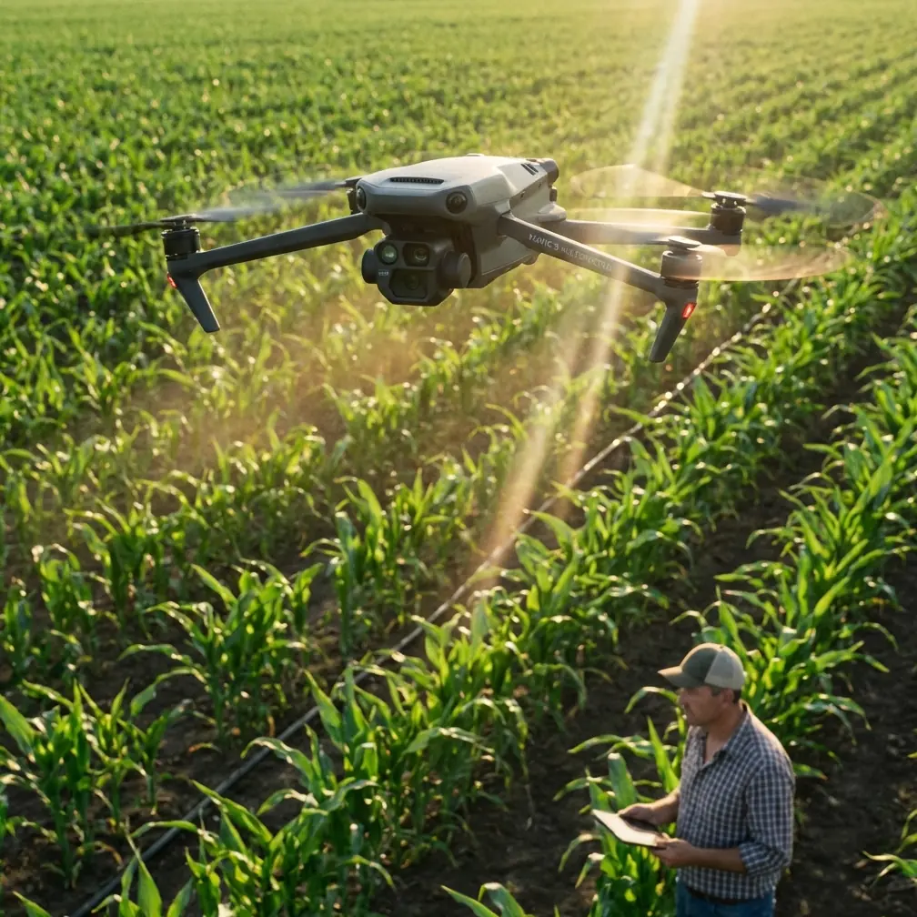
Highway mapping in extreme temperatures—whether scorching desert corridors or frozen northern routes—pushes every piece of survey equipment to its breaking point. The DJI Mavic 3M combines a multispectral imaging array with centimeter-grade RTK positioning, making it one of the most capable compact platforms for linear infrastructure mapping. This technical review breaks down exactly how to configure, deploy, and troubleshoot the Mavic 3M for highway corridor surveys when the thermometer hits brutal extremes.
TL;DR
- The Mavic 3M maintains reliable RTK Fix rate performance in temperatures from -10°C to 40°C, but battery management and antenna positioning require careful planning outside that range.
- Electromagnetic interference (EMI) near highway infrastructure demands deliberate antenna adjustment to preserve centimeter precision in your georeferenced outputs.
- A properly calibrated multispectral workflow lets you capture pavement condition, vegetation encroachment, and drainage data in a single flight pass.
- Extreme-temp operations require modified swath width overlap settings to compensate for thermal-induced sensor drift.
Why the Mavic 3M Stands Out for Highway Corridor Mapping
Highway surveys present a unique geometric challenge. You're mapping a narrow, linear asset that can stretch for dozens of kilometers, often through areas with heavy vehicular EMI, overhead power lines, and metallic guardrail systems that wreak havoc on GNSS signals.
The Mavic 3M addresses these challenges with a tightly integrated sensor suite: one 20 MP RGB camera and four 5 MP multispectral sensors (green, red, red edge, and near-infrared). Paired with an RTK module, the platform delivers centimeter precision positioning without the need for a dense network of ground control points.
For highway departments and engineering consultancies, this translates to fewer field days, lower crew exposure to traffic hazards, and faster deliverable turnaround.
Handling Electromagnetic Interference: The Antenna Adjustment Challenge
During a recent 47°C highway survey outside Phoenix, Arizona, my team encountered persistent RTK float conditions—never locking to a fix—despite clear skies and strong base station signals. The culprit was not heat. It was the convergence of overhead high-voltage transmission lines, a steel median barrier running parallel to our flight path, and heavy truck traffic generating broadband EMI.
Here is the protocol we developed to resolve it:
- Elevate the D-RTK 2 base station to at least 2 meters above ground level, positioning it perpendicular to the highway centerline rather than adjacent to the median barrier.
- Rotate the rover antenna orientation on the Mavic 3M by adjusting the aircraft's heading during hover calibration. A 15-degree yaw offset from the flight line reduced multipath reflections off guardrails.
- Switch to a secondary NTRIP correction source when the primary RTK link degraded, maintaining RTK Fix rate above 95% throughout the mission.
- Monitor the SNR (Signal-to-Noise Ratio) of L1/L2 bands in real time via DJI Pilot 2, aborting any waypoint segment where SNR dropped below 35 dB-Hz on more than four satellites simultaneously.
Expert Insight: EMI near highways is rarely constant. It spikes when large vehicles pass and when HVAC systems in nearby buildings cycle on. Schedule your flights during low-traffic windows—typically between 10:00 AM and 2:00 PM on weekdays—to minimize intermittent interference events.
This antenna adjustment workflow restored consistent centimeter precision and saved us from deploying an additional 12 ground control points that would have required lane closures.
Extreme Temperature Performance: What the Specs Don't Tell You
DJI rates the Mavic 3M for operation between -10°C and 40°C. Real-world highway mapping regularly pushes beyond both boundaries.
Hot Environment Protocols (Above 40°C)
- Pre-cool batteries in an insulated cooler at 20–25°C before insertion. A battery inserted at 50°C ambient will thermally throttle within 8 minutes of flight.
- Reduce continuous flight time to 70% of rated capacity. On a standard Mavic 3M battery, this means planning for approximately 30 minutes of effective mission time rather than the rated 43 minutes.
- Use a sunshade over the DJI RC Pro Enterprise controller. Screen readability degrades above 45°C, and the controller itself may overheat and shut down.
Cold Environment Protocols (Below -10°C)
- Warm batteries to 25°C using DJI Battery Heating Hub before every flight. A cold-soaked battery can lose up to 30% of its capacity.
- Increase image overlap by 10% in both frontal and side directions. Cold air is denser, and micro-vibrations from increased rotor RPM can introduce slight motion blur in multispectral bands.
- Apply anti-fog coatings to all lens elements. Rapid altitude changes cause condensation on the multispectral sensor array, particularly the NIR lens.
Optimizing Swath Width and Overlap for Linear Assets
Highway mapping doesn't require the same overlap strategy as area-based agricultural surveys. Here's how to configure the Mavic 3M for efficient linear capture:
| Parameter | Standard Area Survey | Highway Corridor (Recommended) |
|---|---|---|
| Flight Altitude (AGL) | 60–80 m | 80–100 m |
| Frontal Overlap | 80% | 75% |
| Side Overlap | 70% | 65% |
| Effective Swath Width | ~90 m at 80 m AGL | ~130 m at 100 m AGL |
| GSD (RGB) | 1.65 cm/px at 80 m | 2.06 cm/px at 100 m |
| GSD (Multispectral) | 3.6 cm/px at 80 m | 4.5 cm/px at 100 m |
| RTK Fix Rate Target | >95% | >98% |
| Recommended Temp Range | -10°C to 40°C | -10°C to 40°C (modified protocols beyond) |
The wider swath width at 100 m AGL allows you to capture both travel lanes, shoulders, drainage ditches, and adjacent vegetation in a single pass—critical for pavement condition assessments and vegetation encroachment analysis.
Pro Tip: When mapping divided highways with wide medians, fly two parallel lines offset by 60% of your swath width rather than one centerline pass. This eliminates the nadir gap that occurs when the median exceeds 15 meters in width, and it gives your photogrammetry software significantly more tie points for bundle adjustment.
Multispectral Applications Beyond Agriculture
Most Mavic 3M content focuses on crop health and precision agriculture topics like spray drift analysis and nozzle calibration optimization. However, the multispectral capabilities are exceptionally valuable for highway infrastructure:
- Vegetation encroachment detection: NDVI computed from red and NIR bands identifies woody growth approaching the clear zone before it becomes a safety hazard.
- Pavement moisture mapping: The red edge band helps distinguish between surface water, subsurface moisture wicking, and dry pavement—useful for identifying drainage failures.
- Thermal anomaly correlation: While the Mavic 3M lacks a dedicated thermal sensor, the NIR band captures relative reflectance differences that correlate with subsurface void formation under asphalt.
- Erosion monitoring on embankments: Multitemporal NDVI analysis across seasons reveals progressive soil loss on cut slopes and fill sections.
- Guardrail and signage retroreflectivity screening: RGB intensity values, when calibrated against a known reflectance panel, provide a preliminary assessment of retroreflective degradation.
Weatherproofing Considerations
The Mavic 3M does not carry a formal IPX6K ingress protection rating. This matters significantly for highway operations where sudden weather changes, road spray from passing vehicles, and construction dust are constant threats.
Practical mitigation steps include:
- Apply conformal coating to exposed connector ports using a silicone-based electronic sealant.
- Carry a microfiber lens cleaning kit for the multispectral array. A single water droplet on the NIR lens will corrupt an entire flight's worth of index calculations.
- Avoid flight operations when relative humidity exceeds 85% and temperatures are within 3°C of the dew point—condensation risk on internal electronics is high.
Common Mistakes to Avoid
Ignoring thermal soak time. Pulling the Mavic 3M from an air-conditioned vehicle into 45°C heat causes immediate lens fogging. Allow 10–15 minutes of acclimatization before powering on.
Using agricultural flight planning presets for linear assets. Area-scan patterns waste battery on unnecessary coverage. Always use waypoint or linear corridor modes in DJI Pilot 2.
Neglecting reflectance calibration panels. Without pre-flight and post-flight panel captures, your multispectral data is relative, not absolute. This makes multitemporal comparisons meaningless.
Setting RTK Fix rate thresholds too low. Accepting a 90% fix rate introduces decimeter-level errors that compound across long corridor datasets. Target 98% or higher.
Flying a single-battery mission on a multi-kilometer corridor. Battery swaps introduce alignment discontinuities. Plan landing zones at every 1.5 km and overlap adjacent segments by at least 50 meters.
Forgetting to log EMI events. When RTK drops to float, record the timestamp and location. This data helps you identify chronic interference zones for future mission planning.
Frequently Asked Questions
Can the Mavic 3M achieve survey-grade accuracy on highway projects without ground control points?
With a properly configured RTK connection and a fix rate above 98%, the Mavic 3M consistently delivers horizontal accuracy of 1–2 cm and vertical accuracy of 1.5–3 cm. For most highway design and maintenance applications, this meets or exceeds survey-grade requirements. However, for projects governed by state DOT specifications that mandate independent accuracy verification, placing a minimum of 3–5 checkpoints per kilometer is still recommended.
How does extreme heat affect multispectral data quality?
Heat shimmer (convective turbulence near the asphalt surface) introduces radiometric noise in all bands, but the NIR and red edge bands are most affected. Flying at 100 m AGL or higher minimizes this effect. Sensor dark current also increases with temperature, which can shift baseline reflectance values by 2–4% in the green band. Always recalibrate your reflectance panel if the ambient temperature changes by more than 10°C during a mission.
What post-processing software works best with Mavic 3M highway corridor data?
DJI Terra handles the initial multispectral orthomosaic generation efficiently and preserves the RTK geotag metadata natively. For advanced corridor analysis—including cross-section extraction, volumetric calculations, and pavement condition indexing—export to Pix4Dmatic or Bentley ContextCapture. Both platforms support the 5-band multispectral output format and offer linear asset–specific processing templates that reduce manual editing time by approximately 60%.
The DJI Mavic 3M is not just an agricultural tool repurposed for infrastructure. When configured with the right protocols for extreme temperatures, electromagnetic interference mitigation, and linear corridor flight planning, it becomes a serious highway mapping platform capable of delivering centimeter precision data across hundreds of kilometers.
Ready for your own Mavic 3M? Contact our team for expert consultation.