Mavic 3M in Coastal Forest Surveys: A Field Case Study
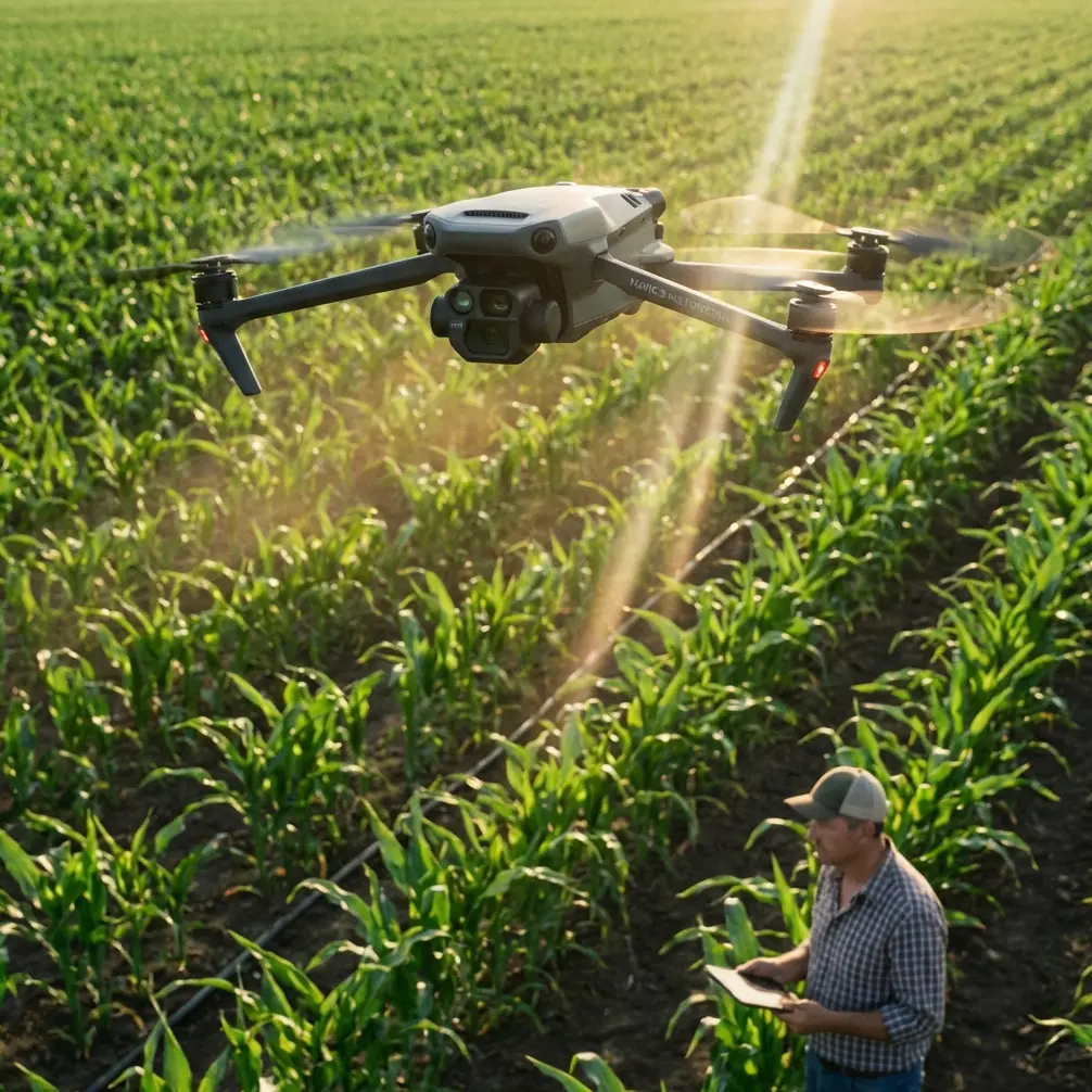
Mavic 3M in Coastal Forest Surveys: A Field Case Study on Seeing the Canopy Clearly
META: A case-study article on using the DJI Mavic 3M for coastal forest surveying, with practical insight on imaging conditions, edge clarity, RTK precision, and why disciplined capture matters in multispectral workflows.
When people discuss the Mavic 3M, the conversation usually lands on sensors, RTK, and vegetation indices. Fair enough. Those are core to the aircraft’s value. But in real coastal forest work, image quality is often decided before any map is stitched or any plant-health layer is generated. It starts with something simpler: separation.
That may sound like a strange word in a multispectral survey article. Yet separation is exactly what determines whether the aircraft gives you clean, useful data over a difficult shoreline forest, or whether the final deliverables are softened by bad edge definition, low-contrast canopy boundaries, and inconsistent segmentation. A recent photography note about smartphone portrait mode, oddly enough, points to a useful lesson here. The article explains that background blur looks more natural when subject distance is appropriate, that messy hair against a similar background can trigger edge recognition errors, and that strong light improves separation while dim scenes make subject boundaries look soft. It also notes that a large aperture is better suited to close-up work where the goal is stronger subject isolation.
Those facts come from consumer imaging, not UAV mapping. Still, the operational message translates surprisingly well to the Mavic 3M in coastal forest surveys: if you want reliable canopy interpretation, you have to manage distance, edge complexity, and lighting with much more discipline than casual operators realize.
Why this matters in a coastal forest
Coastal forests are messy in ways that standard agricultural blocks are not. Tree crowns overlap. Salt-tolerant understory can create mixed reflectance signatures. Wind shifts foliage constantly. The boundary between target canopy and background is rarely clean, especially near tidal margins where branches, reeds, shadows, and bright sand or water all compete inside the same frame.
This is where the Mavic 3M earns its place over more limited imaging platforms. Its multispectral workflow is built for extracting plant-condition information, but that capability depends on collecting crisp, repeatable imagery first. In a coastal survey, “good enough” visual edges are not good enough. If branch outlines, crown limits, and shadow transitions are sloppy, then classification quality falls with them. The result is wasted field time and weaker ecological interpretation.
The smartphone portrait comparison is useful because it highlights a universal imaging truth: edge ambiguity grows when the subject blends into the background. In the phone example, fine hair near a similar backdrop can confuse subject detection. In coastal forest mapping, the equivalent problem is fringe canopy mixing into neighboring vegetation, shadowed understory, or reflective shoreline backgrounds. The Mavic 3M does not operate like a phone’s portrait effect, of course, but the field discipline required to avoid false visual separation is very real.
The case: wind-exposed forest blocks near the coast
In one coastal forest survey scenario, the objective was straightforward on paper: document canopy vigor variations across wind-exposed parcels, identify stress patterns near the shoreline, and align outputs to management grids with centimeter precision. The complication was environmental, not procedural.
The site had three traits that challenged image acquisition:
- Highly textured tree edges at the forest margin
- Bright background transitions caused by open water and sand
- Variable morning haze that reduced local contrast before mid-day
This is exactly the kind of site where the Mavic 3M can outperform less specialized competitors, not because it magically solves bad conditions, but because it gives the survey team enough imaging and positioning discipline to work around them. The multispectral payload provides agronomic and ecological data layers that a standard RGB-only platform cannot match. Pair that with a strong RTK Fix rate and you dramatically improve repeatability, which matters when coastal forests need periodic comparison rather than one-off imagery.
The lesson from the portrait-mode article comes back here: lighting matters more than many operators admit. The reference explicitly says portrait mode works better in sufficient light, while dark environments cause edges to blur more easily. In our forest case, that translated into a simple but crucial planning choice. Flights were delayed until the sun angle and ambient brightness produced stronger separation between upper canopy, shadow zones, and shoreline transition areas. The delay cost less than an hour. It saved much more than that in post-processing cleanup.
Light first, data second
With the Mavic 3M, operators sometimes become overconfident because the platform is purpose-built. That confidence can drift into a bad assumption: the aircraft’s multispectral capability will somehow compensate for poor capture conditions. It will not.
When light is weak, canopy margins flatten visually. Subtle crown differences become harder to distinguish. In extreme cases, even if RTK keeps every image accurately positioned, the data itself is still less interpretable because the scene lacks clean tonal and spectral separation. Accurate coordinates do not rescue muddy imagery.
This is where the smartphone reference offers a surprisingly sharp operational analogy. It warns that in low light, subject edges are more likely to turn blurry. For coastal forestry teams, that means mission timing is not a cosmetic preference. It is a data quality decision. If your flight starts too early in haze or under heavy overcast, the Mavic 3M may still complete the mission flawlessly from a navigation standpoint, but the final canopy interpretation can be materially weaker.
That point is often missed by crews moving from row-crop work into forests. Open fields tolerate more visual simplicity. Forest margins do not.
Distance discipline and swath width
Another reference detail matters: portrait mode only looks natural when the phone stays at a suitable distance from the subject. Again, this is not about copying smartphone technique. It is about remembering that capture geometry affects how well a subject separates from what surrounds it.
In a forest survey, altitude selection and swath width planning serve the same purpose. Fly too high and crown-level detail begins to merge. Fly too low and efficiency drops, while wind-induced motion between frames may become more disruptive. The Mavic 3M gives enough flexibility to tune this balance, but the crew still has to decide what the forest structure demands.
In our coastal case, the best results came from resisting the temptation to maximize area per battery at the expense of detail. A slightly tighter acquisition plan improved crown edge readability and strengthened confidence in stress-zone delineation near the shoreline. That mattered more than squeezing out a wider swath width.
Competitor platforms often advertise broad coverage or simplified workflows. The Mavic 3M excels when the operator treats resolution and repeatability as ecological measurement tools rather than just mission settings. That is a meaningful distinction. In forestry, speed has value. Clean interpretability has more.
Edge recognition errors, forest edition
The phone article mentions that when a person has lots of loose hair against the background, edge recognition errors become more likely. In a drone forestry context, the analogy is obvious to anyone who has looked closely at coastal tree crowns. Needle clusters, wind-frayed branch tips, mangrove fringes, and layered understory create exactly the sort of irregular boundaries that challenge image interpretation.
Why is this operationally significant?
Because forest health decisions are often made at the margin first. Stress tends to appear near exposed edges, drainage transitions, and saline boundaries. If those edges are poorly defined, managers may misread the width or severity of affected zones. A canopy problem that is actually narrow and localized can look broader. Or the reverse.
The Mavic 3M’s multispectral capability helps by adding analytical depth beyond visible imagery, but no sensor abolishes the reality of difficult natural edges. Good teams account for this during flight planning. They choose acquisition windows with better light, maintain stable overlap, and avoid treating every block as if it were a simple agricultural polygon.
That practical mindset is one reason the Mavic 3M performs so well in skilled hands. It does not just collect data. It rewards disciplined data collection.
RTK fix rate and why precision still needs context
The keyword set around this product often includes RTK Fix rate and centimeter precision, and for good reason. In repeat coastal surveys, precise positioning is essential. If the mission objective includes change detection across time, geospatial consistency becomes foundational. Misalignment between survey dates can easily contaminate any attempt to interpret canopy change, shoreline stress, or recovery patterns.
But here is the nuance: precision solves one problem, not all of them.
A strong RTK fix rate ensures the Mavic 3M returns highly reliable spatial alignment. That is a major advantage over lower-tier systems. Yet if the imagery is collected in poor light, with unstable edge contrast, the survey may still require more manual interpretation. Spatial certainty and visual certainty are different layers of quality. You want both.
In our case, centimeter-grade alignment made it possible to compare forest-edge condition across management intervals with confidence. More importantly, because the imagery was captured under brighter, cleaner conditions, the team could trust that observed changes reflected vegetation reality rather than artifacts of soft capture.
That is where this aircraft stands out. Not in isolated specs, but in how its capabilities stack together when the operator respects field conditions.
A note on workflow maturity
There is a pattern I see among teams adopting the Mavic 3M for forest work. Crews with a background in precision agriculture often arrive with strong habits around calibration, overlap, and repeat routes. Those habits help. But coastal forest surveying asks for another level of observational discipline.
You have to watch shoreline glare. You have to watch wind in the canopy. You have to watch how mixed vegetation creates false transitions. And you have to stop assuming that every irregular crown edge is a software issue. Sometimes the problem starts in the scene itself.
That is why I often tell project managers to train pilots using image-separation thinking, not just mission-planning checklists. The portrait-mode reference, simple as it is, captures the essence well: proper distance improves subject separation; sufficient light improves edge clarity; complex boundaries raise recognition errors. Translate that into UAV practice and you get better forest maps.
If your team is refining a coastal forestry workflow around the Mavic 3M and wants to compare mission design choices with someone who works in this niche, this field discussion channel can help: message the project desk.
Where the Mavic 3M clearly outperforms simpler alternatives
Compared with more basic UAV imaging options, the Mavic 3M has a real edge in coastal forest projects because it combines multispectral analysis potential with repeatable precision. A standard camera drone may produce attractive visuals. It may even support decent orthomosaics under ideal conditions. But when the goal is to monitor vegetation stress across irregular coastal habitats, attractive imagery is not the target. Interpretable biological signal is.
That distinction matters.
The Mavic 3M is especially strong when:
- forest margins need to be revisited on a repeat schedule
- subtle canopy stress must be tracked before it becomes visually dramatic
- geospatial consistency is necessary across dates
- mixed habitats make RGB-only interpretation unreliable
What separates strong outcomes from mediocre ones is not simply owning the aircraft. It is flying it with an understanding that edge clarity, scene contrast, and mission geometry shape the quality of every downstream analysis.
Final take from the field
The most useful insight from the supplied reference material is not about phones at all. It is about visual truth. Good imaging depends on enough light, the right working distance, and respect for difficult edges. Those same principles carry directly into Mavic 3M operations over coastal forests.
That is the real story. Not a generic celebration of features, but a field reality: even a highly capable platform performs best when the crew plans for canopy separation the way a skilled photographer plans for subject separation. The forest edge is your “loose hair against the background.” Early haze is your low-light problem. Altitude choice is your distance control. RTK gives you precise placement, while multispectral gives you analytical depth. Combined, they make the Mavic 3M a serious instrument for coastal forestry.
Handled casually, it is just another survey flight. Handled carefully, it becomes a repeatable ecological measurement system.
Ready for your own Mavic 3M? Contact our team for expert consultation.