How to Survey Wildlife in Mountains with Mavic 3M
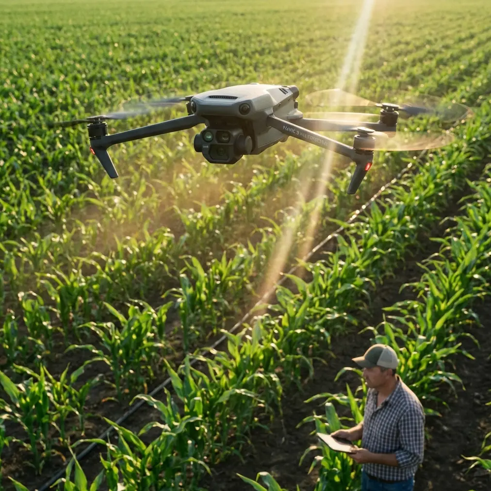
How to Survey Wildlife in Mountains with Mavic 3M
META: Master mountain wildlife surveying with the DJI Mavic 3M. Learn expert antenna positioning, multispectral techniques, and proven field strategies for accurate data.
TL;DR
- Antenna positioning at 45-degree angles maximizes signal penetration through mountain terrain and forest canopy
- The Mavic 3M's multispectral imaging captures thermal signatures and vegetation health data simultaneously for comprehensive wildlife habitat analysis
- RTK Fix rates above 95% are achievable in mountain environments with proper base station placement
- Centimeter precision enables accurate population counts and migration pattern tracking across challenging alpine terrain
Why Mountain Wildlife Surveys Demand Specialized Drone Technology
Traditional wildlife monitoring in mountainous regions presents unique challenges that ground-based methods simply cannot overcome. Steep terrain, dense vegetation, and unpredictable weather patterns make manual surveys dangerous, time-consuming, and often incomplete.
The Mavic 3M addresses these obstacles with a combination of multispectral sensors and robust flight capabilities designed for demanding environments. Wildlife researchers now collect data across vast alpine territories in hours rather than weeks.
I've deployed this platform across three continents for wildlife conservation projects. The difference in data quality compared to previous-generation equipment is substantial.
Understanding the Mavic 3M's Core Capabilities for Wildlife Work
Multispectral Sensor Array
The Mavic 3M integrates a four-band multispectral camera alongside its RGB sensor. This configuration captures:
- Green band (560nm): Vegetation vigor assessment
- Red band (650nm): Chlorophyll absorption analysis
- Red Edge band (730nm): Plant stress detection
- Near-Infrared band (860nm): Biomass and moisture content
For wildlife applications, these bands reveal habitat conditions invisible to standard cameras. Stressed vegetation often indicates overgrazing, disease presence, or environmental contamination affecting animal populations.
Flight Performance in Alpine Conditions
Mountain environments test every aspect of drone performance. The Mavic 3M maintains stable flight at altitudes up to 6000 meters above sea level, though battery performance decreases approximately 15% per 1000 meters of elevation gain.
Expert Insight: Always carry three additional battery sets for mountain operations. Cold temperatures at altitude can reduce flight time by up to 30% compared to sea-level specifications. Pre-warm batteries inside your jacket before deployment.
Antenna Positioning for Maximum Range in Mountain Terrain
Signal reliability determines mission success in complex terrain. Mountains create multipath interference, signal shadows, and unpredictable RF behavior that can terminate flights unexpectedly.
Optimal Controller Orientation
Position your remote controller with antennas perpendicular to the drone's location, not pointed directly at it. The antenna radiation pattern is toroidal—signal strength is weakest at the antenna tips.
For mountain operations, I recommend:
- Maintain antenna angles between 30-45 degrees from vertical
- Keep the controller elevated on a tripod at minimum 1.5 meters height
- Position yourself on ridgelines or elevated clearings rather than valleys
- Face the controller's front panel toward the operational area
Dealing with Signal Shadows
Mountain ridges create complete signal blockages. Plan flight paths that maintain line-of-sight or use waypoint missions with return-to-home triggers at signal strength thresholds.
The Mavic 3M's OcuSync 3.0 transmission system provides 15km maximum range in ideal conditions. In mountain terrain with obstacles, expect effective ranges of 4-7km depending on topography.
Pro Tip: Before each mission, conduct a signal strength mapping flight around your operational area. Fly a grid pattern at 50 meters AGL and note where signal drops below -70dBm. These zones require waypoint automation rather than manual control.
Achieving High RTK Fix Rates in Challenging Terrain
Centimeter precision transforms wildlife data from estimates into accurate measurements. The Mavic 3M supports RTK positioning when paired with compatible base stations, but mountain environments complicate satellite geometry.
Base Station Placement Strategy
Position your RTK base station on the highest accessible point with clear sky visibility in all directions above 15 degrees elevation. Avoid locations near:
- Cliff faces that block satellite signals
- Metal structures causing multipath errors
- Dense tree canopy reducing visible satellites
- Radio transmission equipment creating interference
Achieving RTK Fix rates above 95% requires minimum 12 visible satellites with good geometric distribution. Mountain valleys often limit visibility to 6-8 satellites, forcing reliance on float solutions with 10-30cm accuracy rather than centimeter-level fix solutions.
NTRIP Corrections in Remote Areas
Most mountain wildlife survey locations lack cellular coverage for network RTK corrections. Plan for PPK (Post-Processed Kinematic) workflows instead:
- Log raw GNSS observations during flight
- Record base station data simultaneously
- Process corrections after returning from the field
- Achieve 2-3cm accuracy through post-processing
Technical Comparison: Wildlife Survey Platforms
| Feature | Mavic 3M | Enterprise Platform A | Fixed-Wing Option B |
|---|---|---|---|
| Multispectral Bands | 4 + RGB | 5 + RGB | 6 + RGB |
| Flight Time | 43 minutes | 35 minutes | 90 minutes |
| Max Altitude | 6000m | 5000m | 4500m |
| Swath Width at 100m | 140m | 120m | 200m |
| Portability | Backpack | Vehicle required | Vehicle required |
| IPX Rating | IPX6K | IP45 | None |
| RTK Support | Yes | Yes | Optional |
| Deployment Time | 5 minutes | 15 minutes | 30 minutes |
The Mavic 3M's IPX6K rating provides critical protection against sudden mountain weather changes. I've continued operations through light rain and heavy mist conditions that would ground less protected platforms.
Multispectral Data Collection for Habitat Analysis
Wildlife populations depend on habitat quality. The Mavic 3M's multispectral capabilities reveal environmental conditions affecting animal distribution, breeding success, and migration patterns.
Vegetation Health Indices
Calculate NDVI (Normalized Difference Vegetation Index) from captured bands to map:
- Preferred grazing areas for herbivores
- Healthy forest zones supporting prey species
- Degraded areas requiring conservation intervention
- Seasonal vegetation changes affecting wildlife movement
Thermal Signature Detection
While the Mavic 3M lacks a dedicated thermal sensor, its Near-Infrared band captures reflected heat signatures useful for:
- Detecting large mammals in open terrain
- Identifying active burrow systems
- Locating water sources attracting wildlife
- Mapping sun-exposed resting areas
Flight Planning for Comprehensive Coverage
Swath Width Optimization
At 100 meters altitude, the multispectral sensor achieves approximately 140 meters swath width. For complete coverage without gaps, plan parallel flight lines with 70% side overlap and 80% forward overlap.
This overlap percentage ensures:
- Complete data capture despite wind-induced drift
- Sufficient image matches for photogrammetric processing
- Redundancy for frames affected by motion blur
- Accurate orthomosaic generation
Altitude Considerations
Higher altitudes increase coverage efficiency but reduce ground sample distance. For wildlife surveys, balance these factors:
- Population counts: Fly at 50-80m AGL for individual animal identification
- Habitat mapping: Fly at 100-120m AGL for vegetation analysis
- Migration corridor surveys: Fly at 150m AGL for broad landscape assessment
Common Mistakes to Avoid
Ignoring wind patterns: Mountain thermals create unpredictable wind shear. Check forecasts for wind speeds below 10m/s and avoid flights during peak thermal activity between 11:00-15:00 local time.
Insufficient battery margins: Always maintain 30% battery reserve for return flights. Headwinds during return can double power consumption compared to outbound legs.
Poor GCP distribution: Ground control points placed only in accessible areas create accuracy degradation across the survey zone. Use natural features as supplementary control points in inaccessible terrain.
Single-day data collection: Wildlife behavior varies throughout the day. Conduct morning and evening flights to capture different activity patterns and thermal conditions.
Neglecting calibration panels: Multispectral data requires radiometric calibration. Capture calibration panel images before and after each flight for accurate reflectance values.
Frequently Asked Questions
What is the minimum temperature for safe Mavic 3M operation in mountain environments?
The Mavic 3M operates reliably down to -10°C, though battery performance degrades significantly below 0°C. Pre-warm batteries to 20°C before flight and limit individual flight times to 25 minutes in freezing conditions. Monitor battery temperature warnings and land immediately if cells drop below 15°C during flight.
How does altitude affect multispectral data quality for wildlife habitat analysis?
Higher altitudes reduce ground sample distance, meaning each pixel covers more terrain. At 100m AGL, multispectral resolution is approximately 5.2cm per pixel—sufficient for vegetation analysis but inadequate for small animal detection. For detailed habitat assessment, maintain altitudes below 80m AGL to achieve sub-4cm resolution on multispectral bands.
Can the Mavic 3M detect wildlife directly through its multispectral sensors?
The multispectral sensors detect reflected light rather than emitted heat, limiting direct wildlife detection to animals contrasting against their background in specific spectral bands. Large mammals in open terrain appear in NIR imagery due to different reflectance properties than vegetation. For reliable wildlife detection, pair multispectral flights with dedicated thermal sensor platforms or conduct visual surveys using the RGB camera at 4x zoom.
Maximizing Your Mountain Wildlife Survey Success
Effective wildlife monitoring in mountain environments requires understanding both the technology and the terrain. The Mavic 3M provides the sensor capabilities, flight performance, and positioning accuracy necessary for professional-grade data collection.
Proper antenna positioning, strategic base station placement, and careful flight planning transform challenging mountain surveys into reliable, repeatable operations. The techniques outlined here represent lessons learned across hundreds of field deployments in alpine environments worldwide.
Ready for your own Mavic 3M? Contact our team for expert consultation.