Mavic 3M Field Report: What Actually Matters When
Mavic 3M Field Report: What Actually Matters When Monitoring Remote Forests
META: A field-based expert analysis of using Mavic 3M for remote forest monitoring, focused on sensor integration, data transfer, device choice, and practical workflow lessons from agricultural UAV research.
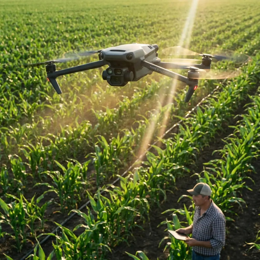
Remote forest monitoring pushes a drone far beyond a tidy demo flight. The aircraft has to travel light, hold a stable link, collect different kinds of data without wasting payload capacity, and remain usable when the operator is standing in glare, heat, and uneven terrain. That is exactly why the older agricultural UAV literature around low-altitude information capture still says something useful about the Mavic 3M today.
I have been revisiting two very different reference threads. One is a research discussion from agricultural remote sensing that argues a simple but still underappreciated point: field conditions rarely ask for just one kind of information. Soil condition, weed presence, and crop vigor each traditionally relied on different sensing approaches, and the paper identifies integrated sensing as a key path forward because it saves airborne space and weight, improves collection efficiency, and lowers acquisition cost. The other is a practical crop survey workflow built around a lightweight DJI platform, where small details such as controller screen choice, outdoor visibility, endurance, and total carry weight ended up shaping real field productivity more than brochure specs alone.
Put those ideas together, and the Mavic 3M becomes easier to evaluate for forestry work. Not as a generic “smart drone,” but as a compact low-altitude information system where payload integration, data handling, and operator ergonomics matter just as much as image quality.
Why the old agricultural sensor argument fits the Mavic 3M so well
The most valuable line in the source material is not about any single airframe. It is the observation that different field questions often demand different acquisition technologies, and that the real breakthrough comes from integrating them into a single sensing workflow. In the farm context, the examples were clear: soil moisture and nutrient status were linked to spectral sensing, weed recognition leaned on shape features, and crop growth monitoring depended on multi-temporal image capture.
Forests present the same problem, only with different targets.
A team monitoring a remote woodland block may want to track canopy vigor, storm damage, pest stress, edge encroachment, road intrusion, regeneration gaps, or post-fire recovery. None of these is best answered by one visual snapshot alone. The operational value of the Mavic 3M lies in how naturally it fits that integrated-data mindset. A multispectral workflow is not just “nice to have” in forestry. It reduces the need to send multiple aircraft or make repeated low-efficiency passes with mismatched payloads. The source document framed this in terms of saving airborne space and mass. That matters in forests because every extra kilogram makes hiking access, launch selection, and battery rotation more difficult.
This is one reason compact integrated systems consistently outperform more fragmented field setups in remote work. When the aircraft, imaging chain, and mission planning are aligned, the operator spends less time improvising and more time collecting comparable data over time. In forest monitoring, repeatability is half the science.
The hidden lesson from a 2-kilogram field kit
The ArcGIS crop-survey reference focuses on an earlier lightweight DJI aircraft, but one practical detail deserves more attention than it usually gets: the full operating set, including the aircraft, shoulder bag, three batteries, and controller, came to about 2 kilograms. That number is not trivial. It explains why lightweight platforms became so effective for field survey work in the first place.
In remote forests, portability is not a convenience feature. It is mission design.
If access requires a steep walk, a narrow trail, or multiple launch points along a transect, a small integrated UAV system gets into the air more often and with less operator fatigue. Larger systems may promise more on paper, but a portable aircraft that actually reaches the second ridge, the stream corridor, and the degraded stand before weather closes in is often the better monitoring tool.
The same source also notes a theoretical flight time of 27 minutes and a theoretical remote-control distance of 5 kilometers for that earlier platform. I would never plan a forest mission around theory numbers alone, but their significance is still operationally relevant: lightweight systems became credible survey tools only when endurance and control margin reached a level where sample blocks could be covered with some redundancy. For Mavic 3M users, the lesson is not to chase brochure range. It is to preserve margin. Forest operations are notorious for signal obstruction, terrain masking, and pressure to “push one more line.” Conservative route planning still wins.
Data transfer is not a side issue in remote forest missions
The agricultural reference makes another point that translates directly to Mavic 3M forestry: a UAV has to transmit several classes of information, including flight attitude, route imagery, and sensor data. Not all of it needs the same urgency. The source explicitly separates lower-priority data, such as crop growth information, from high-priority flight information that must be transmitted in time for control adjustment. It even notes that some non-real-time data can simply be stored on high-capacity cards instead of being sent live.
That distinction is fundamental in remote forest work.
Operators often assume every feed should be immediate. In practice, the most important live stream is usually the one that keeps the aircraft safe, stable, and where it is supposed to be. High-value analysis data can often be reviewed after landing. This matters in hilly or wooded terrain because transmission performance is finite, and interference resilience plus energy efficiency become part of the mission envelope. The source material explicitly mentions anti-interference transmission and energy-saving communication design as constraints for airborne image links. Those are not abstract engineering concerns. In forests, they shape how close you stay to line of sight, whether you break one area into several short sorties, and how much you trust a live preview versus your preplanned grid.
For Mavic 3M teams building a standard operating procedure, I recommend treating telemetry and flight-state awareness as sacred, and treating heavy analysis review as a post-flight task unless the mission truly requires immediate interpretation. That single habit reduces decision clutter in the field.
The controller screen can ruin a good data day
One of the most grounded parts of the crop survey reference has nothing to do with the aircraft at all. It compares iPhone and iPad choices for DJI field use and reports that, in outdoor conditions, smaller phones were easier to hold for long periods but suffered in strong light. The text specifically warns that with screen brightness pushed to maximum, some iPhones could overheat and force brightness reduction after a little over 10 minutes. By contrast, iPad Air-class devices were noted for working more than 6 hours continuously and offering a larger, easier-to-operate display, with a preference for cellular-enabled versions because they could pull imagery basemaps in the field.
This is exactly the sort of detail experienced operators remember.
In remote forest monitoring, a washed-out screen leads to misread overlap, uncertain obstacle spacing, slow response to exposure issues, and more mission restarts than most teams admit. Brightness, reflection, thermal throttling, and battery endurance all affect data quality indirectly by affecting operator confidence. If the mobile screen becomes unreadable at the moment cloud cover shifts or a canopy gap creates tricky contrast, your elegant mission plan stops being elegant.
The source also recommends a simple third-party accessory: a controller sun hood. That may sound minor, but it is the kind of upgrade that improves actual field effectiveness more than many expensive add-ons. For Mavic 3M crews working under exposed sky, a well-fitted sunshade can be the difference between spotting a mapping anomaly on site and discovering it back at the office. If you are refining your own forest workflow and want a quick checklist of field-tested accessory ideas, this WhatsApp field notes line is a sensible place to start.
Multispectral is useful only when the workflow is disciplined
Because the product focus here is the Mavic 3M, it is tempting to center the whole conversation on multispectral capability. That would miss the point. The reference materials repeatedly steer us back to workflow integration. In the agricultural paper, multi-temporal imaging was highlighted for growth monitoring. That concept transfers directly to forests: a single multispectral map tells you something; a sequence captured on a consistent schedule tells you much more.
A forest manager interested in disease progression, replanting success, drainage stress, or seasonal vigor shifts needs temporal consistency more than isolated technical brilliance. Same launch logic. Similar altitude. Similar overlap. Similar light conditions when possible. Similar processing assumptions. Without that discipline, multispectral outputs become colorful but less defensible.
This is also where some of the contextual hints around RTK fix rate and centimeter precision enter the conversation carefully. In forestry, precision positioning is valuable not because every map must boast the smallest possible error figure, but because repeat visits depend on confidently aligning one survey with the next. If the aircraft can repeatedly anchor data to the same spatial reference with strong positional consistency, canopy change analysis becomes much more trustworthy. For corridor edges, drainage lines, access tracks, and regeneration plots, this matters far more than flashy map aesthetics.
What remote forest operators should borrow from agriculture—and what they should not
Agriculture and forestry are not identical operating environments. A crop block is often more open, more regular, and easier to model with clean turns and clearer line of sight. Forests introduce vertical complexity, irregular shadow, and more severe communication masking. Still, the agricultural references offer three durable lessons.
First, integrated sensing beats fragmented field improvisation. The source text’s emphasis on merging disciplinary methods into a unified airborne sensing approach remains exactly right. If your Mavic 3M workflow can answer several ecological or management questions in one sortie sequence, you save not just time but exposure to weather, travel, and pilot fatigue.
Second, transmission priorities should be ranked, not lumped together. The source separates critical flight data from lower-urgency monitoring data, and that is a smarter way to think about forest missions where interference and terrain can punish overconfidence.
Third, the human interface deserves engineering-level attention. The ArcGIS field notes on glare, heat, screen size, and continuous runtime are not peripheral concerns. They are mission-critical. An operator who can clearly see the app, maintain comfort, and work for 6 hours or more with a stable tablet setup will generally produce better survey outcomes than one chasing “lighter and smaller” at all costs.
A practical Mavic 3M mindset for forest monitoring
If I were writing a field protocol for a Mavic 3M team based on these references, it would sound like this:
Carry as little as possible, but not less than the mission needs. Preserve payload and bag weight discipline because mobility determines how many useful launch opportunities you actually get.
Use the aircraft as an integrated sensing platform, not just a camera in the sky. Let the mission answer more than one management question per deployment when conditions allow.
Be selective about what needs to be live. Prioritize aircraft state, control quality, and navigation awareness over the urge to inspect every layer in real time.
Treat the screen setup as part of the aircraft system. Sun hood, high-visibility display, thermal behavior, and endurance all affect mission success.
Value repeatability. Forest monitoring becomes powerful when comparable flights build a time series, not when each sortie is reinvented.
The sources behind this discussion are not about the Mavic 3M specifically, yet they illuminate why aircraft like it matter. One paper from 2015 points to the future through integrated, efficient low-altitude information capture. Another practical field document shows that portability, outdoor usability, and controller-device choice can define success in ways spec sheets rarely capture. Those ideas land cleanly in the present. For remote forests, the best Mavic 3M workflow is not the most complicated one. It is the one that gathers the right mix of information, under real field constraints, with enough consistency to trust what changes over time.
Ready for your own Mavic 3M? Contact our team for expert consultation.