Mavic 3M Best Practices for Coastal Vineyard Work
Mavic 3M Best Practices for Coastal Vineyard Work: What a Flower-Tourism Story Quietly Teaches Us
META: A practical Mavic 3M tutorial for coastal vineyard operators, using a real low-altitude tourism case to explain multispectral planning, RTK precision, battery discipline, wind awareness, and field workflow.
Most Mavic 3M articles stay trapped in product specs. That misses the real question operators face in the field: what kind of work justifies putting a drone in the air, and how do you build a repeatable method around it?
A recent low-altitude aviation story from Chongkan Town offers a useful answer. The area’s rapeseed flowers have entered peak bloom across ten thousand mu, and the local tourism model now includes aerial flower viewing by airship and helicopter. That detail matters far beyond sightseeing. It shows how low-altitude aircraft are becoming part of a new consumption and operations layer around seasonal landscapes. Once people accept the sky as a working corridor for viewing, surveying, and documenting land, smaller professional aircraft like the Mavic 3M stop being niche tools and start fitting naturally into agricultural decision-making.
For a coastal vineyard operator, that shift is practical, not theoretical.
You may not be flying visitors over blooming fields. But you are managing a visually dynamic crop, often under changing coastal wind, salt exposure, uneven vigor, disease pressure, and tight timing windows. The same seasonal spectacle that attracts aerial tourism also creates a strong operational case for aerial sensing. A vineyard at canopy development or pre-harvest has the same basic challenge as a blooming landscape: conditions change quickly, and ground-only observation is too slow and too partial.
That is where the Mavic 3M earns its place.
Why the flower-tourism example matters to vineyard operators
The Chongkan story is simple on the surface: flowers are peaking, visitors go up in aircraft to see them from above. But underneath that is a strong operational lesson. Landscapes in peak biological expression reveal structure from the air that is hard to read from the ground. In flowering rapeseed, aerial perspective captures density, patchiness, drainage patterns, and visual continuity. In vineyards, multispectral mapping turns those same patterns into management signals.
The significance of the source is not the aircraft type. A helicopter can carry tourists; an airship can create an experience. Neither is the right tool for precision vineyard analysis. The significance is that low-altitude flight is being used because the overhead view changes the value of the landscape. For agriculture, the Mavic 3M takes that idea and makes it measurable.
A coastal vineyard especially benefits because visual stress often arrives unevenly. Windward rows may behave differently from sheltered sections. Water movement can vary sharply between blocks. Salt influence, drainage limits, compaction, and canopy density can all create patterns that are spatial before they become obvious at vine level. A multispectral drone gives you a way to see those patterns while there is still time to respond.
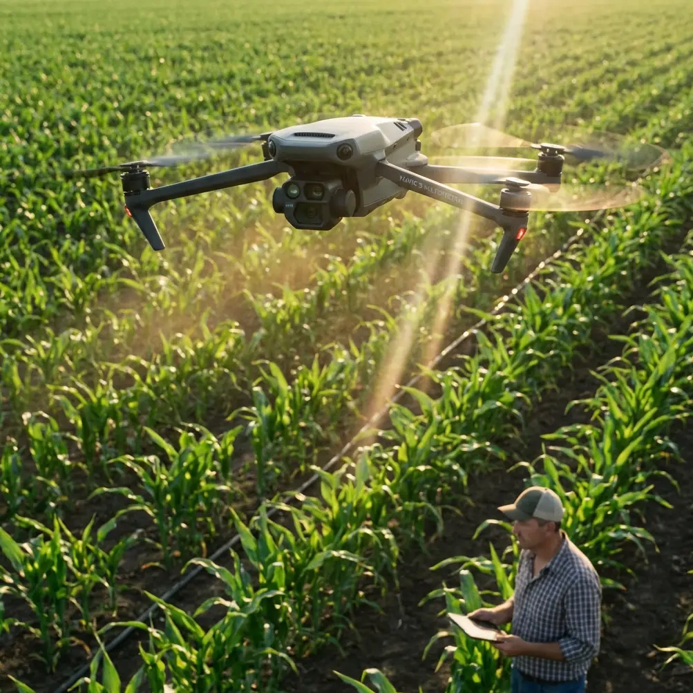
The right role for the Mavic 3M in a coastal vineyard
The Mavic 3M is not a sprayer, so let’s clear that up early. Terms like spray drift, nozzle calibration, and swath width belong to spray operations, and they still matter in your broader program. But they matter here as management context.
If you are delivering a vineyard operation in a coastal environment, one of the biggest hidden costs is poor alignment between sensing and treatment. Teams often spray on calendar logic, then scout after problems spread, then adjust too late. A better sequence is:
- map variability with the Mavic 3M,
- verify problem areas on foot,
- tune nozzle calibration based on actual canopy conditions,
- watch spray drift risk under coastal wind,
- refine swath width and application timing block by block.
That is where the aircraft becomes valuable. Not as a substitute for agronomy, but as the fastest way to target it.
The operational significance of the Chongkan flower story is that timing matters. When rapeseed enters full bloom, the aerial viewing opportunity is immediate and temporary. Vineyards are the same. If you miss the right sensing window, the map may still look impressive, but it will be less useful.
A field workflow that actually works
Here is the tutorial structure I recommend for coastal vineyard teams using the Mavic 3M.
1. Fly for decisions, not for pretty imagery
This sounds obvious, yet many missions are planned backward. Operators launch because the light is nice or the block looks interesting. That is tourism logic. Professional vineyard sensing starts with a question.
Examples:
- Which coastal-facing rows are showing reduced vigor?
- Where is canopy closure uneven ahead of a fungicide round?
- Which blocks need ground checks for water stress?
- Are there areas where prior spray coverage assumptions should be challenged because the canopy architecture changed?
When your question is sharp, flight planning becomes simpler. You know where centimeter precision matters, where overlap needs to be tighter, and how soon the output must reach the field team.
2. Build RTK discipline into every mission
For vineyards, repeatability matters more than a one-time visual snapshot. If you revisit blocks through the season, your maps need to line up cleanly enough to support comparison. That is why RTK Fix rate is not a background technical metric; it directly affects whether your data can support trend analysis and block-level interventions.
In practice, I tell teams to monitor RTK status before they get emotionally attached to the mission. If the fix is unstable, do not assume software will solve it later. In a coastal vineyard, hills, structures, and edge conditions can complicate consistency. A reliable fix supports centimeter precision, which means your scouting notes, historical layers, and management boundaries line up the way they should.
That precision becomes operationally significant when you are comparing stress patterns across time. If the same weak zone appears in the same georeferenced location on multiple missions, you have a management issue to investigate. If your alignment is sloppy, you end up chasing noise.
3. Use multispectral data to narrow your walking, not eliminate it
The Mavic 3M’s multispectral capability is the point of the mission. Still, I see operators overestimate what any map can do by itself. A map can tell you where the canopy is behaving differently. It cannot, on its own, tell you whether the cause is nutrition, disease pressure, root-zone limitation, irrigation irregularity, wind exposure, or a mechanical issue.
That means the correct habit is “map first, walk second.”
This is one reason the flower-tourism story is such a useful contrast. Visitors go airborne for the experience. Vineyard teams should go airborne to reduce uncertainty. The map is a filter. It tells your boots where to go.
In coastal blocks, I often find the highest value comes from identifying transition zones rather than obvious problem zones. A severely weak area is usually already known. The edge between healthy and weakening vines is where management decisions get interesting. Multispectral imagery helps define that edge quickly.
4. Respect wind as both a flight variable and a crop-management variable
Coastal work changes everything. Wind affects aircraft behavior, battery consumption, data consistency, and later treatment quality. This is where operators who separate drone mapping from spray planning lose efficiency.
If your map shows variability in exposed rows, the next question should not be merely “what’s stressed?” It should also be “what does this mean for the next operation?” If a treatment is planned, look ahead to spray drift risk and whether current canopy density requires adjustment in nozzle calibration or route planning for your spraying platform.
The Mavic 3M helps because it gives context. You can identify where canopy is open, where it is denser, and where edge rows may behave differently under wind. That supports smarter decisions on treatment timing and setup. In a coastal vineyard, one-size-fits-all assumptions across the whole site usually cost you accuracy.
The battery management habit that saves missions
Here is the battery tip I learned the hard way in field consulting: do not launch your final block on the battery that “should be enough.”
On paper, many operators think in average flight time. In reality, coastal vineyards are not average conditions. Wind shifts, transit legs are longer than expected, and attention drops late in the day. Add repeated climbs over broken terrain and your reserve disappears faster than the app estimate suggests.
My rule is simple:
- use your freshest batteries for the most distant or wind-exposed blocks,
- avoid stacking your hardest mission at the end of the cycle,
- and rotate packs by actual performance history, not just charge count.
Also, let batteries cool before recharging in warm field conditions. Heat plus fast turnaround degrades confidence. A pack that still “works” may no longer behave predictably under wind load. For mapping missions where consistency matters, predictable batteries are part of data quality, not just flight safety.
This may sound mundane, but it has direct consequences. If your battery profile forces you to rush the last passes, cut overlap, or truncate a boundary, the map loses value. One incomplete mission at a critical growth stage can cost more than the time you thought you saved.
Practical planning for vineyard blocks near the coast
A few field-tested habits make the Mavic 3M far more useful in this environment.
Start earlier than you think you need to
Coastal air often becomes less cooperative as the day develops. Even if the aircraft can handle the conditions, the consistency of the dataset may suffer. Stable light and calmer air make your outputs easier to compare over time.
Separate operational zones by exposure
Do not treat every block as one mapping unit if the site has distinctly different windward and sheltered sections. Breaking missions into logical exposure zones often gives cleaner interpretation later.
Keep treatment teams in the loop
If your mapping is feeding spray or nutrition decisions, the people responsible for nozzle calibration and application setup should see the maps early, not after the work is done. This is how aerial sensing starts improving actual operations rather than living as a reporting artifact.
Track repeat locations
When multispectral imagery repeatedly flags the same area, formalize that zone in your field notes. Repeatability is where drone data becomes management intelligence.
If you need a quick field discussion on mission setup or workflow questions, this direct line is useful: message Marcus here.
What “new consumption scenarios” means for agriculture
One phrase embedded in the source story deserves attention: low-altitude aircraft are becoming a new consumption scenario in flower-sea tourism. For agriculture, the parallel idea is that low-altitude aircraft are becoming a new operating layer.
That shift matters because it changes how farms think about timing and value. Aerial work is no longer reserved for rare events. It becomes part of seasonal routine. In Chongkan, aerial viewing adds value when the flowers are at their peak. In a vineyard, aerial sensing adds value when crop development, stress, or treatment timing creates a narrow decision window.
This is why the Mavic 3M is best deployed as part of a rhythm:
- pre-season baseline,
- early canopy checks,
- targeted scans before treatment decisions,
- verification flights after major weather events,
- and selected late-season missions tied to harvest planning.
Not every week needs a flight. But every flight should answer a question that matters that week.
Where many Mavic 3M programs go wrong
The most common mistake is turning the aircraft into a data generator instead of a management tool. Operators collect layers, archive orthomosaics, and produce maps no one uses in time.
The second mistake is failing to connect mapping outputs to adjacent operations. If a map reveals canopy variability and no one revisits sprayer setup, swath width assumptions, or drift planning, the operational value gets cut in half.
The third mistake is weak consistency. If RTK discipline is poor, battery habits are sloppy, and flight windows are opportunistic, comparisons across the season become less trustworthy.
The fix is not complicated:
- standardize launch checks,
- monitor RTK Fix rate,
- fly comparable windows,
- rotate batteries intelligently,
- and tie every map to one field action.
The quiet lesson from a blooming landscape
The report from Chongkan Town may appear far removed from coastal viticulture. Tourists board airships and helicopters to admire rapeseed in full bloom over a vast flowering landscape. But that story captures something fundamental: once the aerial perspective becomes part of how people engage with land, its value multiplies.
Tourism uses the view for experience. Agriculture uses the view for judgment.
For coastal vineyard teams, the Mavic 3M is at its best when it helps you make earlier, narrower, better decisions. Multispectral mapping should shorten your scouting path, improve your confidence in treatment planning, and reveal patterns you would not reliably catch from the ground. Pair that with solid RTK habits, practical battery discipline, and awareness of how wind affects both flight and spray planning, and the aircraft starts paying for itself in clarity.
The biggest opportunity is not flying more. It is flying with purpose during the moments that matter most.
Ready for your own Mavic 3M? Contact our team for expert consultation.