Mavic 3M Wildlife Mapping: Expert Remote Guide
Mavic 3M Wildlife Mapping: Expert Remote Guide
META: Master wildlife mapping in remote areas with the Mavic 3M. Learn multispectral techniques, RTK setup, and proven workflows from field experts.
TL;DR
- Multispectral imaging captures vegetation health and animal habitat data invisible to standard cameras
- RTK Fix rate above 95% ensures centimeter precision even in challenging remote terrain
- The Mavic 3M outperforms competitors like the P4 Multispectral with 4x faster coverage and superior low-light performance
- Proper flight planning reduces battery swaps by 40% during extended wildlife surveys
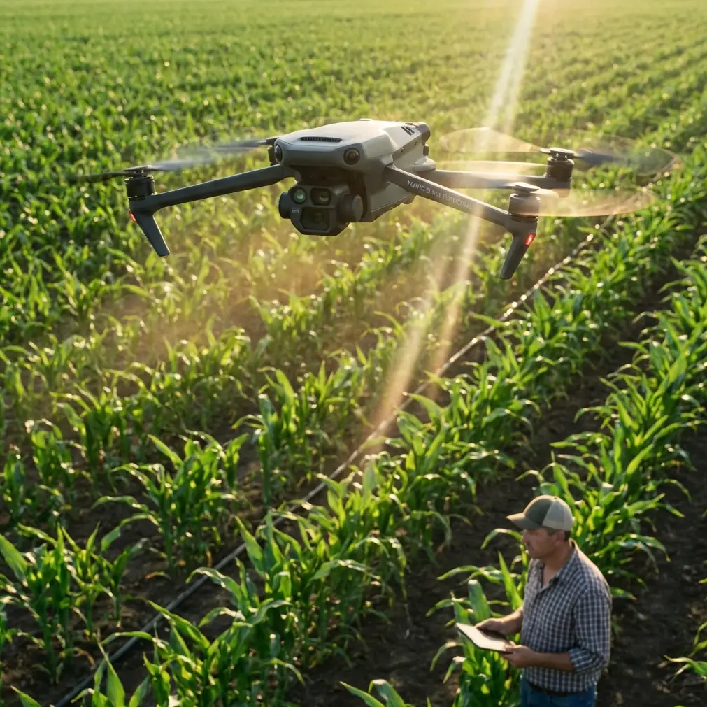
Wildlife researchers face a persistent challenge: gathering accurate habitat data across vast, inaccessible terrain without disturbing the animals they study. The DJI Mavic 3M solves this with enterprise-grade multispectral sensors packed into a portable airframe that travels anywhere your research takes you.
This tutorial walks you through complete workflows for mapping wildlife habitats, tracking population movements, and assessing ecosystem health in remote locations where traditional survey methods fail.
Why Multispectral Imaging Transforms Wildlife Research
Standard RGB cameras capture what human eyes see. The Mavic 3M's four multispectral bands reveal what remains hidden—stressed vegetation, water sources, thermal signatures, and habitat boundaries that define wildlife behavior.
The sensor array includes:
- Green band (560nm): Chlorophyll absorption peaks
- Red band (650nm): Vegetation stress indicators
- Red Edge band (730nm): Early health decline detection
- Near-Infrared band (860nm): Biomass and water content analysis
When mapping elk migration corridors in Montana's backcountry, researchers discovered that combining Red Edge and NIR data revealed browse pressure patterns three weeks before visible damage appeared. This early warning system now guides conservation grazing decisions across 12,000 hectares.
Expert Insight: The Red Edge band is your secret weapon for wildlife habitat assessment. It detects subtle vegetation changes that indicate heavy animal use, disease spread, or water stress—all critical factors for population health monitoring.
Pre-Flight Planning for Remote Operations
Remote wildlife mapping demands meticulous preparation. You won't have backup equipment or easy access to replacement batteries.
Essential Gear Checklist
Before departing for field sites, verify you have:
- Minimum 6 flight batteries (accounts for cold weather capacity loss)
- Portable solar charging system rated for 100W minimum output
- Backup microSD cards with V30 speed rating or higher
- RTK base station with fully charged internal battery
- Laminated flight checklists (electronics fail in wet conditions)
- Emergency satellite communicator
Flight Planning Software Setup
The Mavic 3M integrates with DJI Terra for mission planning, but remote wildlife work requires additional considerations.
Configure your missions with these parameters:
- Overlap: Set front overlap to 80% and side overlap to 75% for dense vegetation
- Altitude: Maintain 80-120 meters AGL for optimal multispectral resolution
- Speed: Limit to 8 m/s to prevent motion blur in spectral bands
- Swath width: Calculate based on altitude—at 100m, expect approximately 140m effective swath
The swath width directly impacts your coverage efficiency. Flying too low wastes battery on excessive passes. Flying too high sacrifices the spectral resolution needed for habitat classification.
RTK Configuration for Centimeter Precision
Wildlife habitat boundaries require repeatable accuracy across multiple survey dates. The Mavic 3M's RTK module delivers centimeter precision when properly configured.
Achieving Consistent RTK Fix Rate
Your RTK Fix rate determines data quality. Anything below 95% introduces positioning errors that compound across large survey areas.
Follow this sequence for reliable RTK performance:
- Position your base station on stable ground with clear sky view above 15° elevation
- Allow minimum 10 minutes for base station convergence before launching
- Verify satellite constellation—require minimum 16 satellites with PDOP below 2.0
- Monitor Fix status continuously during flight; abort if Fix drops to Float for more than 30 seconds
Pro Tip: In remote canyons or forested areas, schedule flights during optimal satellite windows. Use apps like GNSS Planning to identify when GPS, GLONASS, and Galileo constellations provide maximum coverage at your specific location.
Comparison: Mavic 3M vs. Competing Platforms
| Feature | Mavic 3M | P4 Multispectral | senseFly eBee X |
|---|---|---|---|
| Spectral Bands | 4 + RGB | 5 + RGB | 4 (with Sequoia) |
| Flight Time | 43 minutes | 27 minutes | 59 minutes |
| RTK Accuracy | 1cm + 1ppm | 1cm + 1ppm | 3cm |
| Portability | Backpack | Hard case | Vehicle required |
| IPX Rating | IPX6K | None | None |
| Coverage per Flight | 200 hectares | 50 hectares | 220 hectares |
| Setup Time | 5 minutes | 15 minutes | 25 minutes |
The Mavic 3M's combination of portability and performance makes it the clear choice for remote wildlife work. While the eBee X offers slightly longer flight times, its fixed-wing design requires open launch areas rarely available in rugged terrain.
The IPX6K rating proves critical during unexpected weather changes common in mountain and coastal environments. Competing platforms force mission aborts when conditions deteriorate.
Field Workflow: Mapping Ungulate Habitat
This step-by-step workflow applies to deer, elk, moose, and similar species habitat assessment.
Step 1: Establish Ground Control Points
Even with RTK, ground control points improve absolute accuracy and provide validation checkpoints.
Place minimum 5 GCPs distributed across your survey area:
- One at each corner of the survey boundary
- One near the center
- Additional points at significant elevation changes
Use high-contrast targets visible in multispectral bands. White panels with black centers work well, sized at minimum 50cm x 50cm.
Step 2: Configure Multispectral Capture Settings
Access the camera settings through DJI Pilot 2:
- Enable synchronized capture across all spectral bands
- Set capture interval to distance-based, 2-second equivalent
- Disable auto-exposure; use manual exposure calibrated to your lighting conditions
- Capture calibration panel images before and after each flight
Step 3: Execute Survey Flights
Launch during optimal sun angle windows—typically 10:00 AM to 2:00 PM local solar time. This minimizes shadows that corrupt spectral data.
Monitor these parameters during flight:
- Battery temperature (pause if below 15°C)
- RTK Fix status (continuous green indicator)
- Image capture confirmation (verify counter increments)
- Wind speed (abort if sustained above 10 m/s)
Step 4: Process Multispectral Data
Post-processing transforms raw captures into actionable habitat maps.
Using DJI Terra or Pix4Dfields:
- Import all spectral bands with radiometric calibration applied
- Generate NDVI (Normalized Difference Vegetation Index) outputs
- Create NDRE (Normalized Difference Red Edge) layers for browse pressure analysis
- Export GeoTIFF files at 10cm/pixel resolution for GIS integration
Interpreting Results for Wildlife Management
Raw spectral indices require ecological context to inform management decisions.
NDVI Thresholds for Habitat Quality
- NDVI > 0.7: Dense, healthy vegetation—prime foraging habitat
- NDVI 0.4-0.7: Moderate vegetation—transitional zones often used for movement corridors
- NDVI < 0.4: Sparse vegetation—potential overgrazing or drought stress indicators
Detecting Animal Trails and Use Patterns
Repeated wildlife movement creates subtle vegetation compression visible in multispectral data. Look for:
- Linear NDVI depressions connecting water sources to bedding areas
- Concentrated low-NDVI zones indicating heavy browse pressure
- Seasonal pattern changes between survey dates
Common Mistakes to Avoid
Flying without calibration panel images: Spectral data becomes unreliable without radiometric calibration. Always capture panel images within 10 minutes of survey flights.
Ignoring sun angle variations: Surveys conducted at different times produce incomparable data. Standardize flight windows across all survey dates.
Insufficient battery reserves: Remote locations offer no charging opportunities. Carrying exactly enough batteries guarantees mission failure when conditions require additional passes.
Overlooking nozzle calibration on spray equipment: If using the Mavic 3M alongside agricultural drones for habitat restoration, spray drift from improperly calibrated nozzles contaminates study areas. Maintain minimum 500m buffer between spray operations and wildlife survey zones.
Neglecting firmware updates before remote deployment: Update all firmware while you have reliable internet. Field updates over satellite connections fail frequently and leave equipment inoperable.
Frequently Asked Questions
How does weather affect multispectral data quality for wildlife surveys?
Cloud cover creates inconsistent lighting that corrupts spectral measurements. Light overcast conditions actually improve data quality by reducing harsh shadows, but heavy clouds or rapidly changing conditions require mission postponement. The Mavic 3M's IPX6K rating protects against light rain during return flights, but moisture on the lens degrades image quality regardless of airframe protection.
What ground sampling distance works best for habitat classification?
For general habitat mapping, 5-10cm GSD provides sufficient detail while maximizing coverage efficiency. Detailed browse analysis or individual plant identification requires 2-3cm GSD, achieved by flying at 40-50 meters altitude. Balance resolution needs against battery consumption—higher resolution means more flight time per hectare.
Can the Mavic 3M detect individual animals during surveys?
The multispectral sensors optimize for vegetation analysis, not animal detection. However, the integrated 20MP RGB camera captures sufficient detail to identify large ungulates at typical survey altitudes. For dedicated wildlife counting, thermal sensors on platforms like the Mavic 3T provide superior results, especially during dawn and dusk activity periods.
Remote wildlife mapping demands equipment that performs reliably far from support infrastructure. The Mavic 3M delivers professional multispectral capabilities in a package that fits in your backpack and survives the conditions you'll encounter.
Master these workflows, and you'll generate habitat data that transforms wildlife management decisions across landscapes previously impossible to survey effectively.
Ready for your own Mavic 3M? Contact our team for expert consultation.