Mavic 3M in Thin Air: A High-Altitude Solar Farm Case Study
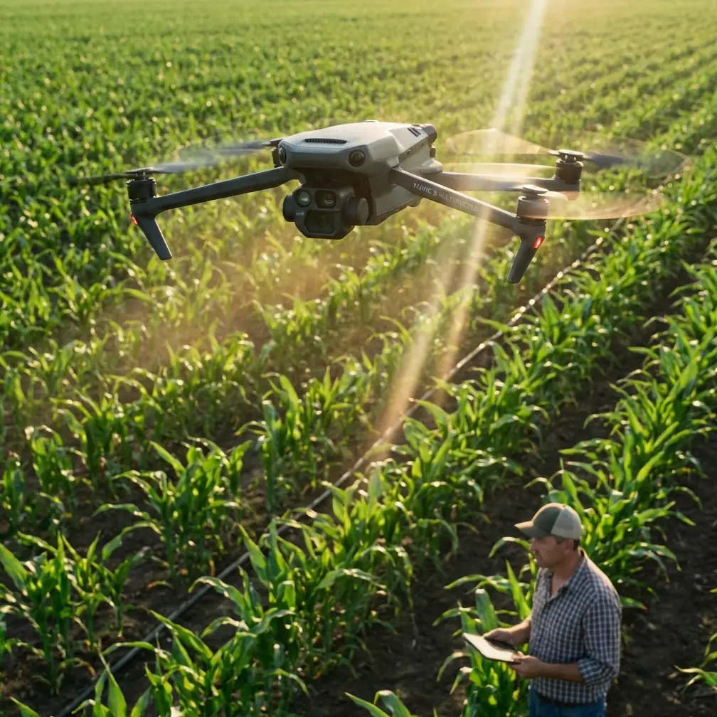
Mavic 3M in Thin Air: A High-Altitude Solar Farm Case Study
META: A field-driven look at how the Mavic 3M performs for high-altitude solar farm monitoring, with practical guidance on multispectral use, battery management, and image interpretation.
High-altitude solar sites ask more from a drone program than most operators expect. The panels stretch for acres, the light is harsh, winds shift without warning, and battery behavior changes enough to disrupt a routine mission. In that setting, the Mavic 3M is not just a mapping aircraft. It becomes part inspection tool, part decision-support system, and part discipline test for the crew flying it.
I recently worked through a monitoring scenario that captures this well: a solar farm at elevation, where the operations team wanted cleaner vegetation intelligence around panel rows, repeatable geospatial data, and imagery that could be used by non-pilots without a long explanation. That last part matters more than many teams admit. A technically perfect dataset can still fail if the imagery does not point viewers toward a clear operational conclusion.
That principle echoes a recent photography piece published on 2026-03-24, which emphasized a deceptively simple idea: every image should carry a definite theme, and the viewer should be led toward a specific thought rather than left with a pile of visual information. For Mavic 3M operators, that is not an artistic side note. It is operational guidance. If your multispectral flight over a solar farm does not make the maintenance issue legible at a glance, you have work to do before the next mission.
Why high-altitude solar monitoring is different
Solar farms in high terrain create three overlapping problems. First, the aircraft works in thinner air, which changes power draw and can shrink your safety buffer late in a mission. Second, the environmental contrast is severe: reflective panels, bare ground, scrub growth, shadow bands, and access roads all compete inside the same frame. Third, management teams want outputs that are actionable quickly, not images that require a remote sensing specialist to decode every time.
This is where the Mavic 3M earns its place. Its multispectral workflow is useful not because “multispectral” sounds advanced, but because it can separate subtle vegetation conditions around panel infrastructure that standard RGB often flattens into a single green-brown band. On steep or elevated sites, that helps teams spot uneven growth, drainage-linked stress patterns, and encroachment zones that can affect maintenance access and long-term site efficiency.
The point is not to fly more data. It is to fly sharper questions.
The mission brief: not just “map the site”
On this project, the site team initially asked for a full aerial pass of the farm. That request was too broad to be useful. We reframed it into three operational questions:
- Where is vegetation pressure building fastest around panel rows and perimeter fencing?
- Which areas need follow-up ground inspection before scheduled maintenance?
- Can the outputs be understood immediately by operations staff who were not on the flight?
That reframing changed everything. Flight planning became more disciplined. Swath width decisions were tied to the features we actually needed to resolve. Multispectral outputs were organized around maintenance priorities instead of generic map layers. Even the post-flight review became faster because we were evaluating whether the imagery supported decisions, not admiring coverage statistics.
This is where the photography lesson becomes surprisingly relevant. The source article asked, in essence, what thought the photographer wants to communicate and what the viewer will associate with the image after seeing it. In drone operations, especially with the Mavic 3M, that translates into a practical rule: each mission output should answer one primary question clearly. If a map tries to explain vegetation vigor, drainage, panel shading patterns, access routes, and thermal anomalies all at once, the result is often confusion.
What the Mavic 3M did well on site
The Mavic 3M’s value at this location came from consistency. At altitude, consistency matters more than headline capability. You need repeatable geotagging, stable data capture windows, and enough control over flight layout to revisit the same blocks later. That is where centimeter precision and RTK-linked workflows become more than specification-sheet terms. When maintenance crews need to return to a narrow strip between panel arrays, “close enough” is not close enough.
A strong RTK Fix rate helped keep the map outputs aligned from one session to the next, which reduced the time spent reconciling whether a vegetation hotspot had actually expanded or whether we were just looking at slight positional mismatch between flights. That sounds minor until you are comparing trends over weeks. Then it becomes the difference between credible monitoring and visual guesswork.
The multispectral data was especially useful around sections where surface appearance in RGB suggested uniform conditions, but the crop and weed response along drainage channels told a different story. At a solar farm, vegetation is not merely aesthetic clutter. It affects access, can increase maintenance burden, and may signal underlying water movement that could shape erosion patterns or ground stability over time.
A battery management lesson from the mountain
The most useful field lesson from this job had nothing to do with software. It was battery timing.
At high altitude, I avoid treating battery percentages as if they mean the same thing they mean at lower sites. On this mission, the first pack looked normal through the early portion of the route, then dropped faster than expected once the aircraft turned into a stronger wind band on the return leg. That is the kind of flight that punishes confidence.
My rule now is simple: in elevated solar work, I split the site into smaller blocks than the map would suggest on paper, and I preserve a more conservative return threshold than crews often use at lower elevations. I also keep batteries insulated before launch instead of letting them sit exposed in cold morning air on a tailgate while the team talks through the route for fifteen minutes. That one habit has saved more mission stability than any clever post-processing trick.
The Mavic 3M can absolutely work these sites efficiently, but thin air and variable temperatures compress your margin. A pack that feels fine at takeoff can behave differently after several long, straight lines, especially once the aircraft has to fight wind over a broad, exposed array. Break the mission sooner than your ego wants. Finish with more reserve than the map planner says you need. Your data quality improves when your aircraft is not spending the last third of the mission flying under silent pressure.
Why “theme” matters in an industrial workflow
The strongest insight from the March 24 photography article was the insistence on a clear theme. It argued that a picture should not stop at showing visible objects; it should carry deeper meaning and trigger a response in the viewer. In a solar farm monitoring workflow, that becomes a discipline for report design.
For example, if a multispectral map is meant to support vegetation management, then every deliverable should reinforce that objective:
- color treatment should make risk zones obvious,
- annotations should direct attention to maintenance priorities,
- and comparison panels should answer “what changed?” quickly.
Too many drone reports bury the operational story under layers of export options. The client does not need every available rendering. They need the version that leads to action. On this site, the best-performing output was not the most technically dense one. It was a side-by-side visual set that made one message unmistakable: growth pressure was intensifying along specific drainage-adjacent corridors and those corridors should be inspected before the next maintenance cycle.
That is what it means for imagery to have a theme in industrial drone work. Not mood. Direction.
A note on cross-sector pressure in the drone market
There is another recent development worth paying attention to, even if it sits outside solar operations on paper. On 2026-03-23, Terra Drone announced a full-scale move into the defense equipment market and said it plans to establish a U.S.-based subsidiary, Terra Defense, by the end of fiscal year 2026. That is a strategic signal, not just corporate news.
Why does it matter to someone flying a Mavic 3M over a solar farm? Because it reflects how unmanned systems are being pushed toward higher reliability, tighter data standards, and more specialized mission roles across the board. When major drone companies expand into defense-oriented structures, the broader market often feels the effects in procurement expectations, software assurance, operational documentation, and the demand for mission-specific outcomes rather than general-purpose flying.
For commercial operators, that means clients are becoming less tolerant of vague workflows. They want documented repeatability. They want clean mission logic. They want evidence that your aircraft, sensor stack, and crew procedures are matched to the job. High-altitude solar inspection is not defense work, but it exists in the same larger shift toward disciplined unmanned operations.
Interpreting multispectral data without overpromising
One of the easiest mistakes with the Mavic 3M is assuming that multispectral outputs automatically produce certainty. They do not. They produce a different layer of evidence. Used well, that layer can sharpen decisions around vegetation management, drainage attention, and follow-up inspection priorities. Used poorly, it becomes decorative science.
At this solar farm, we treated the multispectral results as a screening mechanism. Areas showing stronger contrast patterns near panel rows were flagged for ground verification rather than declared problematic on sight alone. That kept the workflow honest. It also built trust with the site team, because the drone data was presented as a decision aid tied to field confirmation, not a magic answer engine.
This is especially important at high altitude where lighting conditions can change quickly, and where terrain and shadow interactions can complicate interpretation. Your mission design, time-of-day discipline, and revisit consistency matter just as much as the sensor.
Practical planning notes for Mavic 3M crews
A few field habits improved this operation significantly:
- Tighten swath width when vegetation detail around panel corridors is the real objective.
- Watch RTK Fix rate throughout the mission rather than assuming early lock guarantees the whole sortie.
- Segment large arrays into manageable flight blocks to protect battery reserve in wind.
- Standardize launch timing so each monitoring run happens under comparable light conditions.
- Build deliverables for maintenance supervisors, not just GIS staff.
None of these are glamorous. All of them matter.
I would add one more: brief the report before you fly the mission. Decide what the final map or image set needs to say, then collect for that purpose. If your audience should walk away thinking “inspect the west drainage corridor before next week’s mowing cycle,” then design the entire sortie around producing that clarity.
If you are refining a workflow like this and want to compare mission structure against your own site conditions, this is a useful place to continue the conversation: message Marcus directly.
The real takeaway for Mavic 3M operators
The Mavic 3M is often discussed as a sensor platform. That is accurate, but incomplete. On demanding solar sites, especially at altitude, its real value comes from how well it fits into a disciplined monitoring method.
The method is what separates useful outputs from busy aerial documentation.
This case reinforced three things for me. First, battery management at elevation deserves more conservatism than many crews give it. Second, RTK-backed positional consistency is not optional if the client wants defensible trend analysis. Third, the best drone imagery is not the most elaborate. It is the imagery that points viewers toward a clear conclusion.
That last point connects the two recent news items more than it might seem at first glance. One source focused on the inner logic of a photograph: the image should communicate a defined thought and leave the viewer with something meaningful to interpret. The other highlighted a drone company formalizing its move into a more demanding market, with a U.S. subsidiary planned by the end of fiscal year 2026. Put together, they sketch the direction of professional UAV work. Better images. Stronger purpose. Less tolerance for ambiguity.
For Mavic 3M teams monitoring solar farms in high altitude, that is the standard now. Fly with precision. Interpret with restraint. Deliver with intent.
Ready for your own Mavic 3M? Contact our team for expert consultation.